
Visibility
Definition
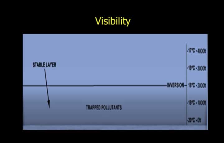
- Meteorological Optical Range (Visibility) is the distance to which prominent objects can be seen and recognised by the naked eye.
- Stable conditions in high-pressure areas cause poor visibility since polluted or moist air is not permitted to rise.
- Meteorological offices report the lowest horizontal visibility around the airfield.
- Smoke, dust, sand, precipitation, and suspended water droplets reduce visibility.
Visibility by Day and Night
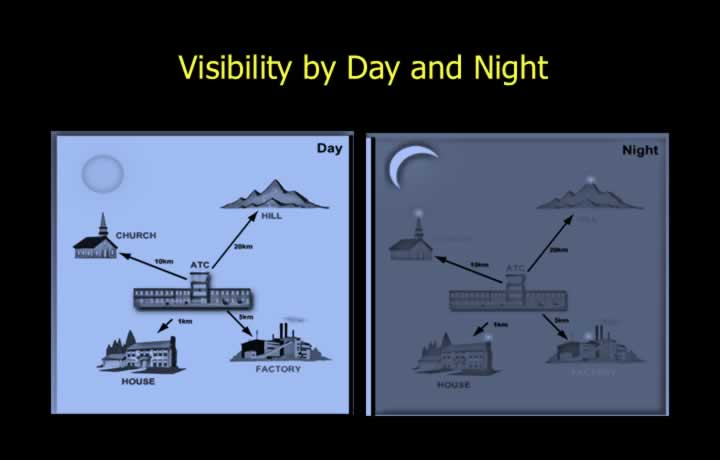
- Day visibility: greatest horizontal distance at which a dark object near the ground can be recognised against a bright background.
- Night visibility: greatest distance at which a lighted object of 1000 candle power can be recognised against an unlit background.
- Gold’s visibility meter or scopograph are used for measurement.
- A graduated filter and distant light of known intensity are used to determine meteorological visibility.
Variation of Visibility
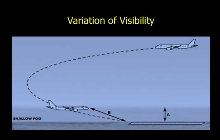
- Slant visibility refers to visibility from an altitude; it may be poorer than vertical visibility.
- Oblique visibility occurs when viewing through fog; it improves when climbing above haze.
- Visibility varies along the flight path and may not always match reported meteorological visibility.
- Looking into the sun reduces visibility; looking away improves it.
Runway Visual Range (RVR)
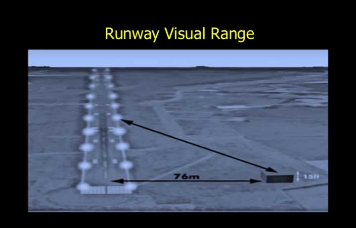
- Runway Visual Range is the maximum distance a pilot can see runway markings or lights along the runway.
- RVR is reported when it is less than 1500 m.
- A transmissometer measures light intensity along the runway using photoelectric cells.
RVR Report
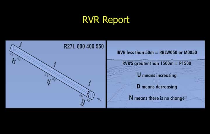
- RVR is reported every 15–30 minutes in defined intervals.
- Intervals:
- 0–200 m: 25 m intervals
- 200–800 m: 50 m intervals
- Above 800 m: 100 m intervals
- Example: R27L 600 400 550 (touchdown, midpoint, stop-end values).
Mist, Haze, and Fog
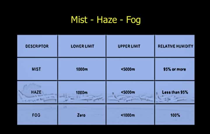
- Mist: visibility 1000–5000 m, relative humidity ~95%.
- Fog: visibility below 1000 m, relative humidity ~100%.
- Smog: mixture of smoke, haze, and fog.
- Fog dissipates when temperature rises above dew point.
Smoke, Sand, and Dust Haze
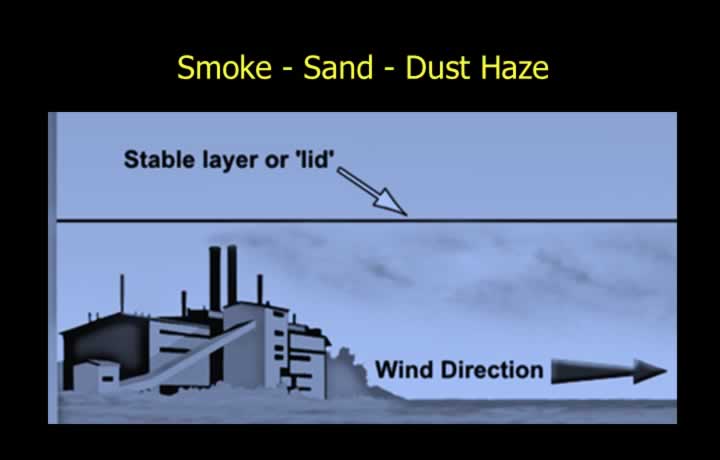
- Smoke haze: caused by industrial or vehicle emissions.
- Haze: suspended particles reducing visibility below 5000 m.
- Dust/sand haze: common in deserts, extending up to 6–8 km.
- Dust storms can reduce visibility below 1000 m.
Rain, Snow, Sea Spray, and Volcanic Ash
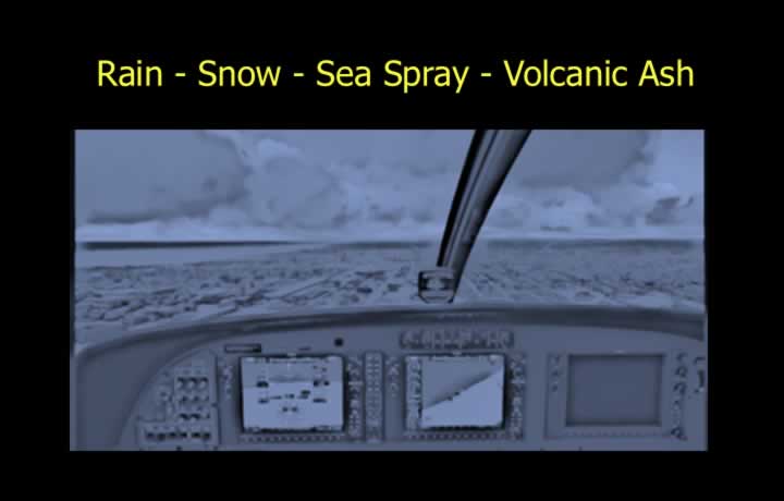
- Heavy rain and snow can reduce visibility below 1 km.
- Moderate rain may reduce visibility below 10 km.
- Sea spray consists of salt particles over ocean surfaces.
- Volcanic ash significantly reduces visibility and affects aviation.
Radiation Fog
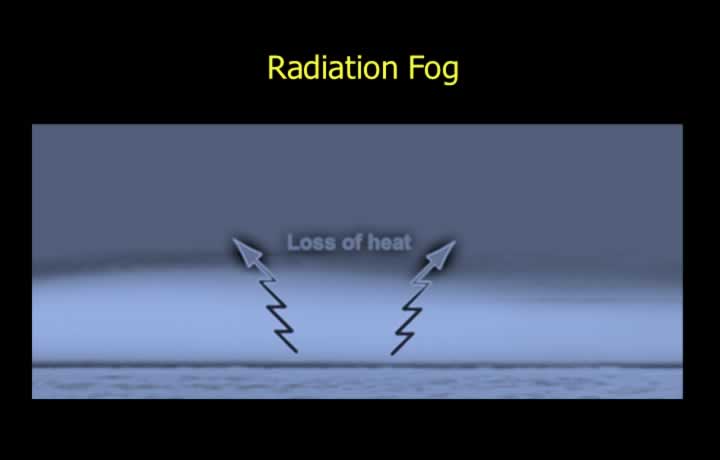
- Forms due to nocturnal cooling of the ground by conduction.
- Occurs in stable atmosphere, high humidity, clear skies, and light winds.
- Light winds (3–7 knots) allow fog formation up to 1 km or 1500 ft.
- Fog dissipates after sunrise due to surface heating or mixing.
Location of Radiation Fog
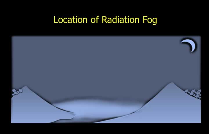
- Radiation fog forms over land at night in high pressure or col areas
- Valley floors provide moisture source from rivers increasing probability of Radiation Fog
- During winter months radiation fog can be seen after the passage of western disturbance
- Fog dissipates when surface air gets warmer above dew point after sunrise
- Introduction of hygroscopic nuclei to create water droplets also dissipates fog
- Radiation fog also dissipates due to advection of dry winds into the area converting fog into low level stratus clouds
Hill and Advection Fog
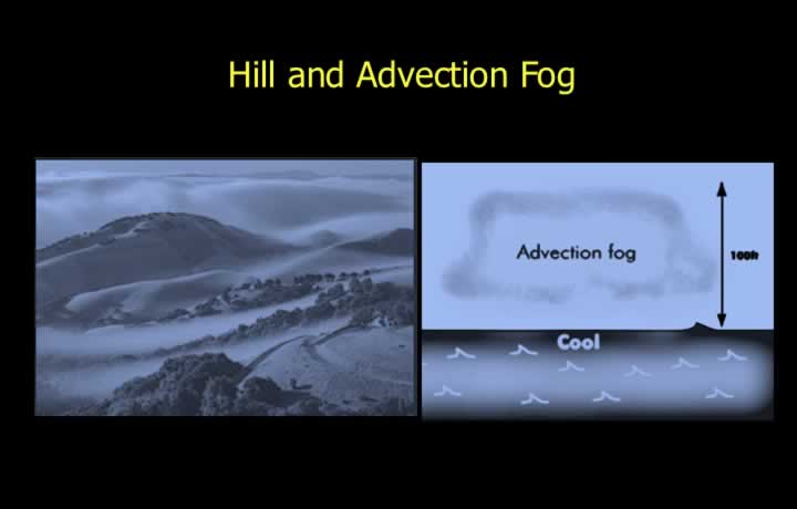
- Hill fog covers hilltops, reducing visibility below 200 m.
- Advection fog forms when warm moist air moves over a cold surface.
- Common in coastal regions such as Bengal and Odisha.
- Requires high humidity, cold surface, and moderate winds.
Frontal and Steaming Fog
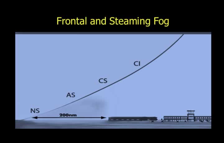
- Frontal fog occurs along frontal boundaries, especially warm fronts.
- Steaming (sea smoke) occurs when cold air moves over warm sea water.
- Common in polar regions and can extend up to 500 ft above sea level.