
Thunderstorm
Types of Thunderstorms
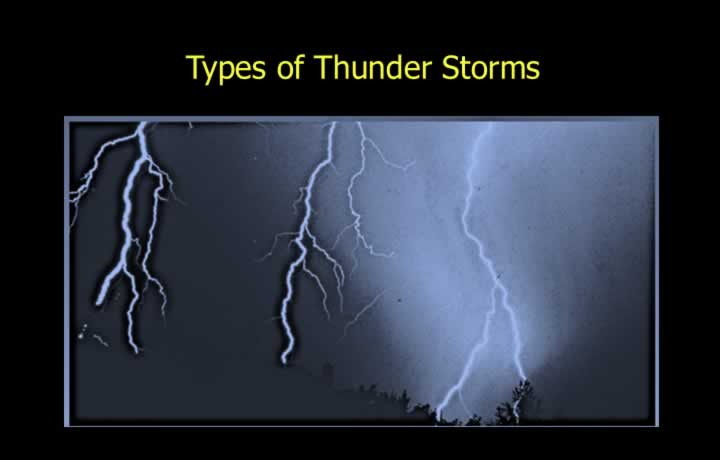
- A thunderstorm (TS) is caused by intense convective currents within Cumulonimbus (Cb) clouds and is officially reported when thunder is heard.
- The diameter of a Cumulonimbus cloud can be as much as 10 km.
- Single-cell thunderstorms usually occur during the non-winter months due to intense surface heating (air-mass thunderstorms).
- Multi-cell cluster thunderstorms are commonly associated with mountains, cold fronts and low-pressure systems.
- Multi-cell line thunderstorms develop along squall lines associated with frontal systems.
- Supercell thunderstorms may extend into the stratosphere and are capable of producing tornadoes.
Conditions for Thunderstorm Formation
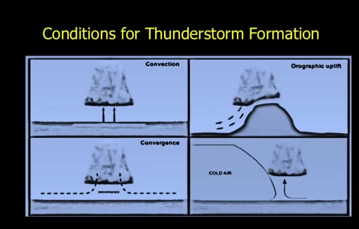
- Thunderstorms develop in an unstable atmosphere where the Environmental Lapse Rate (ELR) is greater than the Saturated Adiabatic Lapse Rate (SALR).
- High humidity and a triggering mechanism are essential for thunderstorm formation.
- Common lifting mechanisms include:
- Surface heating (Insolation) causing local convection.
- Orographic lifting.
- Convergence of air.
- Frontal lifting.
- Radiational (Katabatic) cooling.
Heat and Orographic Thunderstorms
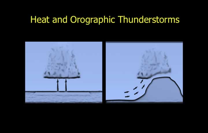
- Heat (Air-Mass) Thunderstorms develop due to intense afternoon heating and the formation of heat lows.
- Low pressure causes convergence of warm, humid air, leading to the development of Cumulonimbus clouds.
- Orographic thunderstorms occur when warm, moist air is forced to rise over mountainous terrain, particularly during the afternoon.
Steady-State and Frontal Thunderstorms
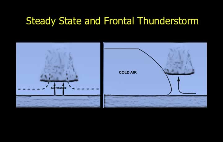
- Steady-state thunderstorms form due to prolonged convergence associated with winds or upper-air troughs.
- Frontal thunderstorms usually develop along cold fronts and occasionally along warm fronts.
- Strong uplift of warm, moist air along a cold front can produce thunderstorms during both day and night.
Line Squall (Squall Line)
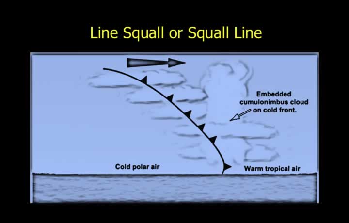
- Squall lines consist of a series of thunderstorms arranged in a line.
- They are typically located 100–300 km ahead of a cold front.
- Squall lines may be embedded within layered clouds, making them difficult to detect visually and therefore particularly hazardous.
Mesoscale Convective Complex (MCC)
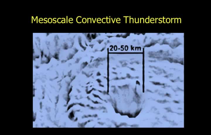
- A Mesoscale Convective Complex (MCC) consists of multiple clusters of thunderstorms.
- MCCs may cover very large areas and are capable of producing cyclones, tornadoes and flash floods.
Cumulus Stage of a Thunderstorm
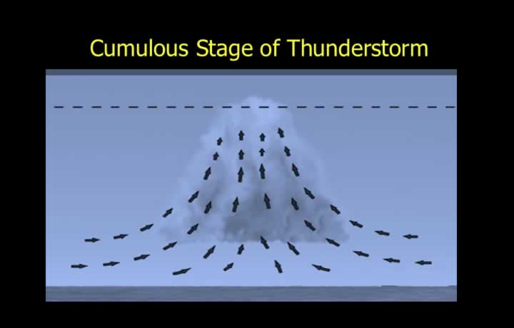
- The initial growth phase of a thunderstorm is known as the Cumulus Stage and typically lasts 15–20 minutes.
- The rising air cools initially at the Dry Adiabatic Lapse Rate (DALR) until saturation occurs.
- After saturation, cooling continues at the Saturated Adiabatic Lapse Rate (SALR), allowing Cumulus clouds to develop into Cumulonimbus clouds.
- Only updrafts exist during this stage, while rain and ice particles grow within the cloud.
- Entrainment (inflow of surrounding air into the cloud) occurs during this stage.
Mature Stage of a Thunderstorm
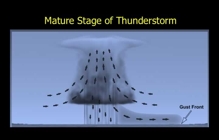
- The Mature Stage is the most violent stage and generally lasts 20–40 minutes.
- Precipitation reaches the ground during this phase.
- Both strong updrafts and down-drafts are present until the entrained air becomes relatively dry.
- Roll clouds and Shelf clouds are commonly observed during this stage.
Dissipating Stage of a Thunderstorm
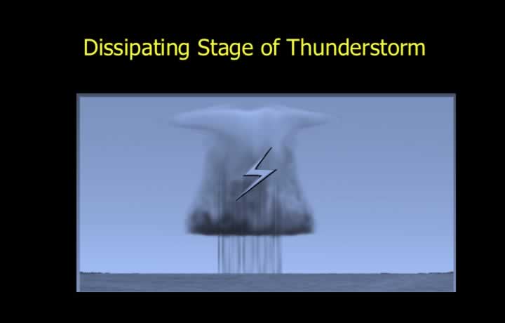
- The Dissipating Stage is the final phase of a thunderstorm.
- Only down-drafts remain, preventing any further cloud development.
- Weak down-drafts continue at low and middle levels.
- The cloud develops a characteristic anvil top with false cirrus.
- Light rain may continue during this stage.
Secondary Thunderstorms
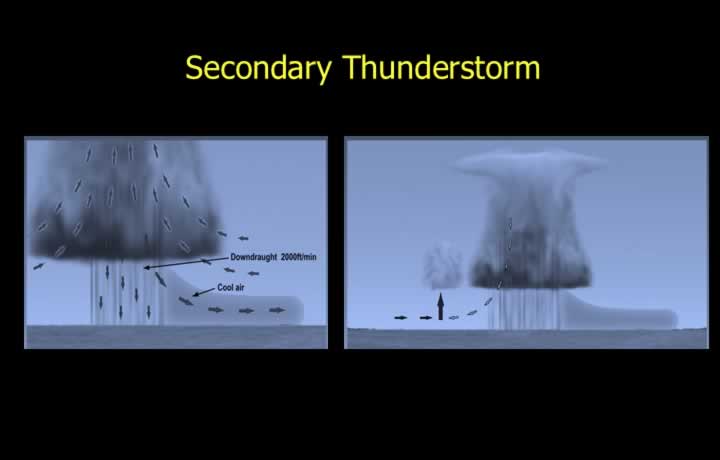
- Secondary thunderstorms develop when cold down-drafts create squalls and gust fronts accompanied by heavy showers.
- The cold gust front undercuts warm air, forcing it upward.
- The rising moist air develops additional Cumulonimbus cells.
- Down-drafts from the parent storm interact with low-level winds, creating convergence that produces daughter cells.
- This repeated process results in multicell thunderstorms.
Movement of Thunderstorms
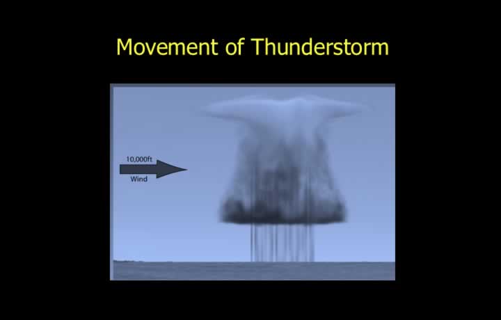
- Thunderstorms generally move with the prevailing winds at approximately the midpoint of the cloud’s vertical extent.
- The direction and speed of movement are mainly controlled by winds near 10,000 feet or between the 700 hPa and 500 hPa pressure levels.
Supercell Thunderstorms
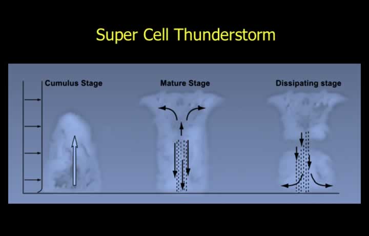
- In ordinary thunderstorms, down-drafts during the mature stage suppress further upward growth.
- Supercell thunderstorms develop under conditions of extreme instability, abundant moisture and strong vertical wind shear.
- Typically, the atmosphere is relatively stable near the surface but highly unstable at higher levels.
Supercell Development
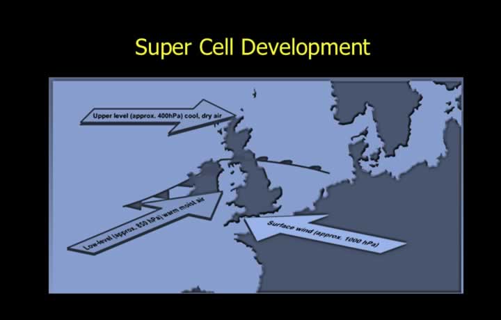
- Supercells initially develop under slight instability, which increases with continued surface heating.
- Vertical wind shear results from winds blowing from different directions and at different speeds with height.
- Wind shear tilts the thunderstorm, separating the updrafts from the down-drafts.
- This separation allows the storm to continue growing into a long-lived supercell.
Thunderstorm Reporting
- Light Thunderstorm: Characterised by faint thunder.
- Moderate Thunderstorm: Loud thunder, lightning, showers and winds between 15–40 knots.
- Severe Thunderstorm: Continuous thunder and lightning, heavy showers and winds exceeding 40 knots.
- Over plains, thunderstorms usually occur during the afternoon.
- Over valleys, thunderstorms are more common at night and during the early morning.
- Over the sea, thunderstorms are generally more frequent during the night.
- In mid-latitudes, thunderstorms are most common during summer, whereas in the tropics they are often associated with winter cold fronts.
- The first gust associated with a thunderstorm usually produces a sudden increase in atmospheric pressure.
- Thunderstorms are forecast by comparing existing atmospheric conditions with those required for development and by monitoring weather radar and satellite imagery.
- Aircraft should avoid thunderstorms by a wide margin, especially at lower altitudes.
- Jet streams create upper-level wind shear that tilts the updrafts and supports the development of supercell thunderstorms.
Dust and Sand Storms
- Dust and sand storms develop over desert regions under conditions of high temperature, low humidity and atmospheric instability.
- Slight moisture intrusion may produce Cumulonimbus clouds that generate strong winds, lifting dust to heights of about 10,000 feet and reducing visibility to as little as 50 metres.
- During the pre-monsoon season, these storms resemble thunderstorms with relatively low cloud tops and precipitation that evaporates before reaching the ground.
- Norwesters approach from the northwest over Bengal and are associated with violent thunderstorms and squall lines.
- Tornadoes are rotating funnel clouds formed by intense convergence and low-level wind shear.
- Waterspouts are tornadoes that develop over water and may lift spray, water and debris.
- Dust Devils are small rotating columns of air formed by localized surface heating, capable of lifting dust to heights of about 2 km and reaching diameters of up to 10 km.