
Low Pressure Systems
Heat Low
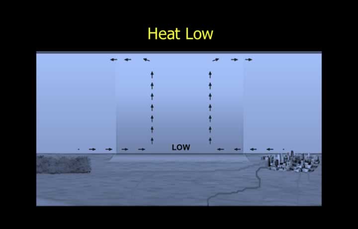
- Heat lows are areas of low pressure created due to surface heating.
- Warm air converges and rises to higher levels.
- The rising air expands and cools adiabatically, causing small-scale depressions.
- Rising air due to heat lows condenses at the freezing level and forms cumuliform clouds.
- Cumuliform clouds produce showery precipitation, which may be rain or hail depending on the surface temperature.
Heat Low over Land and Sea
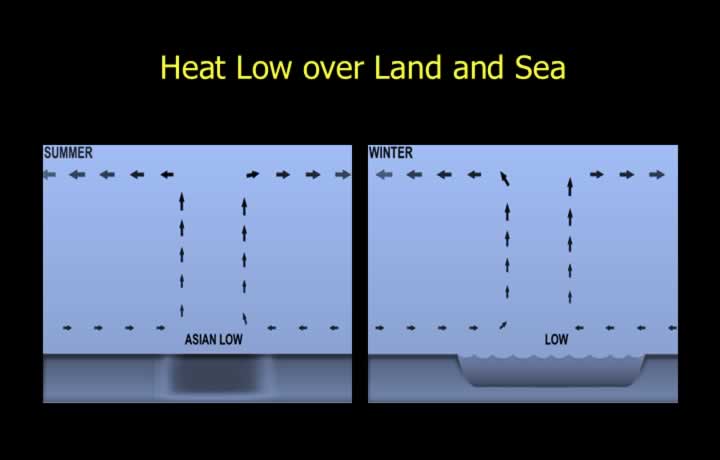
- Land warms and cools more rapidly than the sea because soil has a lower specific heat than water.
- Over land, heat lows form due to rapid heating of the landmass during summer.
- Over the sea, heat lows develop during winter when sea surface temperatures are higher than adjacent land.
Equatorial Low Pressure
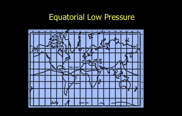
- Equatorial low pressure forms near the Equator due to intense surface heating and the rise of warm air.
- A similar phenomenon occurs at the boundary between the Ferrel and Polar Cells.
- The Inter-tropical Convergence Zone (ITCZ) is a broad equatorial low-pressure belt that shifts with the thermal equator.
- As the Sun’s apparent position moves, the equatorial low-pressure belt migrates between the Tropic of Cancer and the Tropic of Capricorn.
Tropical Revolving Storm (TRS)
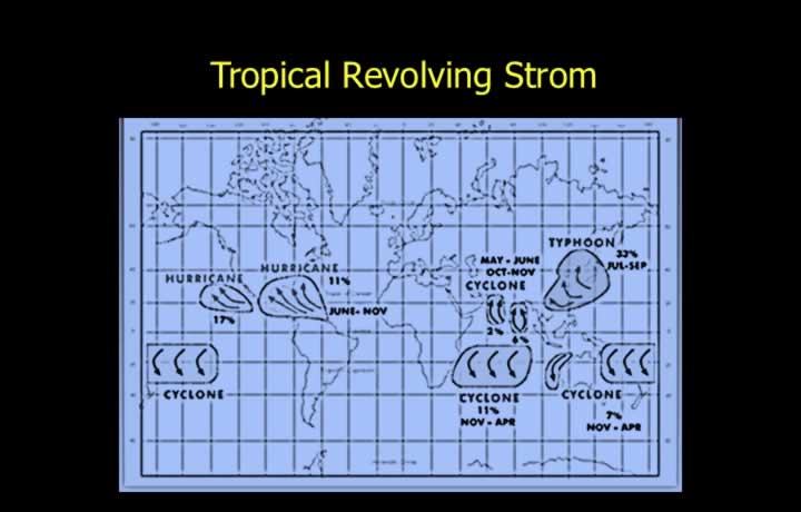
- Tropical Revolving Storms (TRS) occur in tropical regions.
- Depending on the region, they are known as cyclones, hurricanes, or typhoons.
- Wind speeds exceed 65 knots in a TRS.
- A TRS may extend over an area with a diameter ranging from 300 to 1500 km.
Frontal Depressions
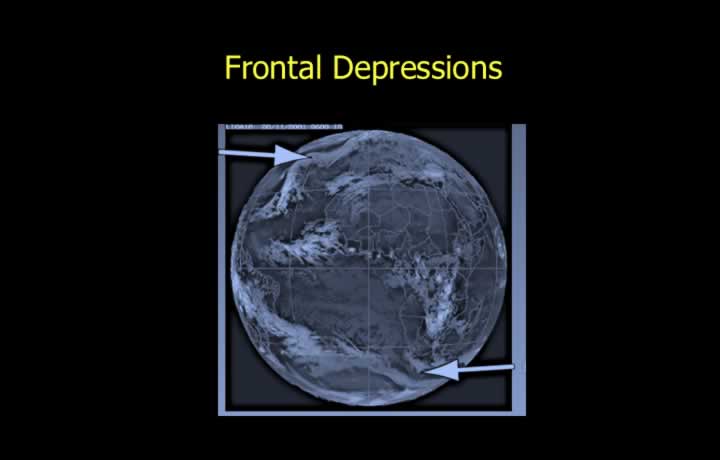
- Frontal depressions are low-pressure systems formed by the interaction of air masses with different temperatures.
- They develop mainly in temperate latitudes.
- Polar depressions form where Polar Continental and Tropical Maritime air masses meet.
Formation of Frontal Depression
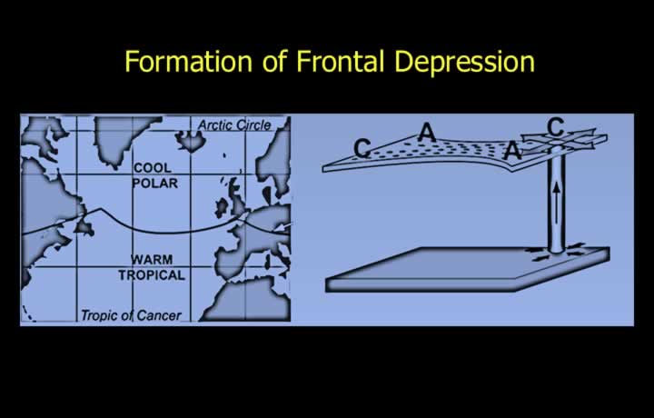
- The surface air process and upper air process together form a frontal low or depression.
- The surface air process occurs when warm tropical air meets cool polar air along the polar front, creating low pressure.
- Irregularities in the frontal surface create kinks where warm air intrudes into cold air, producing lower surface pressure due to the less dense warm air.
- The upper air process is associated with jet streams that create regions of net loss and net gain of air aloft.
- Areas experiencing a net loss of upper air develop low pressure at the surface as air rises.
Isobaric Trough
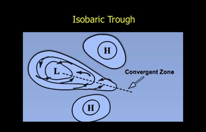
- Isobaric troughs are elongated extensions of low pressure and can be as active as a depression.
- Winds converge along trough lines, creating a convergence zone.
- Trough weather resembles cold front weather, with Cumulonimbus clouds, severe turbulence, icing, and precipitation.
- Trough lines are also visible on upper-air charts and produce weather similar to surface troughs.
Orographic Low
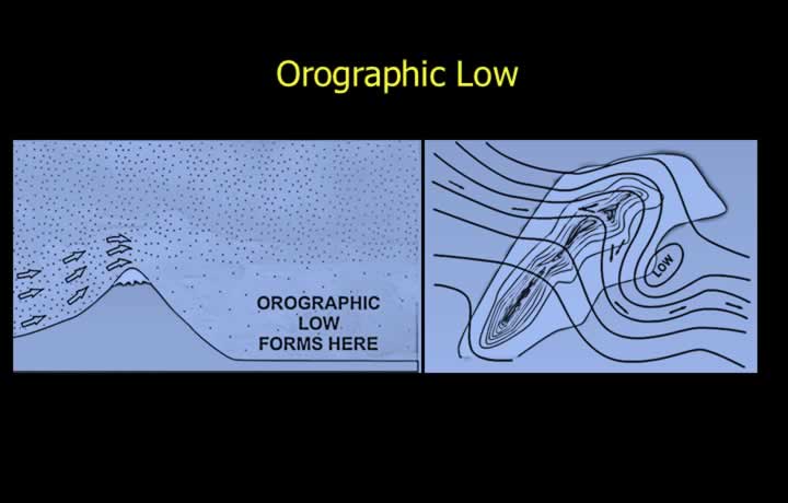
- Lee lows develop on the leeward side of mountains where airflow is blocked by the terrain.
- Lee troughs or lows generally form under stable atmospheric conditions due to limited vertical motion.
- Air depletion on the leeward side produces unpredictable wind conditions.
- Flying below ridge level is not recommended because of sudden updrafts and down-drafts.
- Lee troughs or lows develop when winds blow at right angles to mountain ranges.
Lee Low in Cold Front
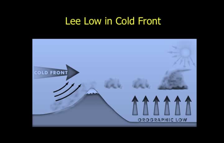
- Stable conditions ahead of a cold front favor the formation of an orographic low.
- Orographic low pressure causes strong winds and significant heating on the leeward side of mountain slopes.
Polar Low
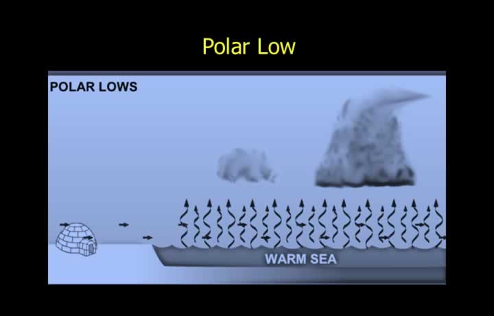
- Polar low pressure develops when cold Arctic air moves over relatively warm seas.
- Warm air rises over the sea, drawing cold air from the surrounding land.
Monsoon Low
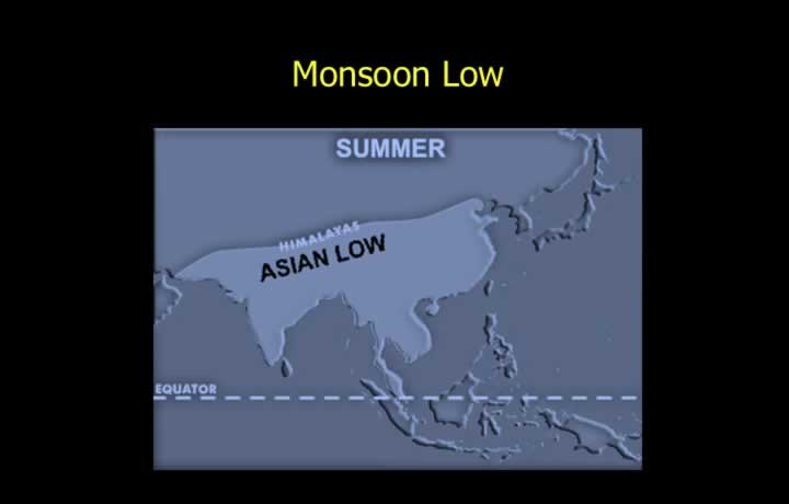
- Monsoon low-pressure systems develop over the Tibetan Plateau due to intense heating of the landmass.
Aviation Hazards in Low Pressure Systems
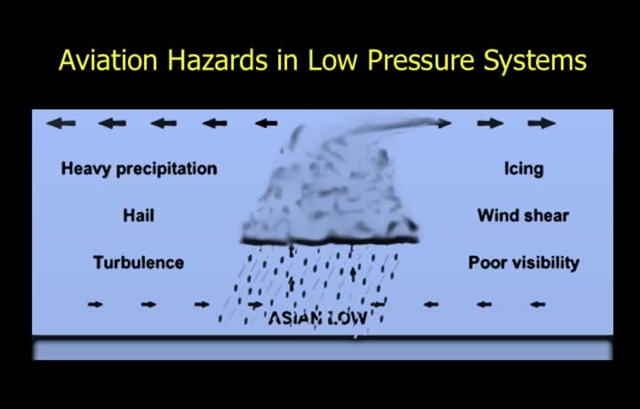
- Turbulence results from rising air within clouds and descending air outside the clouds.
- Icing is caused by supercooled water droplets when cloud temperatures are below the freezing point.
- Visibility is generally good in low-pressure systems except inside clouds.
- Showery precipitation, including heavy rain or hail, may occur beneath cumuliform clouds.
- Wind shear may be encountered while flying near Cumulonimbus (CB) clouds.