
Aerodrome Meteorological Report
METAR, SPECI and SPECIAL
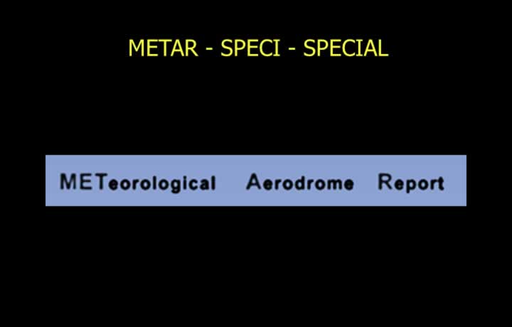
- Aerodrome Meteorological Reports are classified as METAR, SPECI, and SPECIAL.
- METAR is a routine aviation weather report issued every 30 minutes by meteorological offices. A trend (landing) forecast is appended.
- SPECI is a selected special weather report issued for significant changes in weather conditions since the previous METAR.
- SPECI is issued immediately for deterioration in weather conditions and after a 10-minute interval for improvements.
- A trend forecast is appended to SPECI reports.
- SPECIAL is a local version of SPECI intended only for the originating ATC unit and is not transmitted to other stations.
Location, Date, Time and Wind
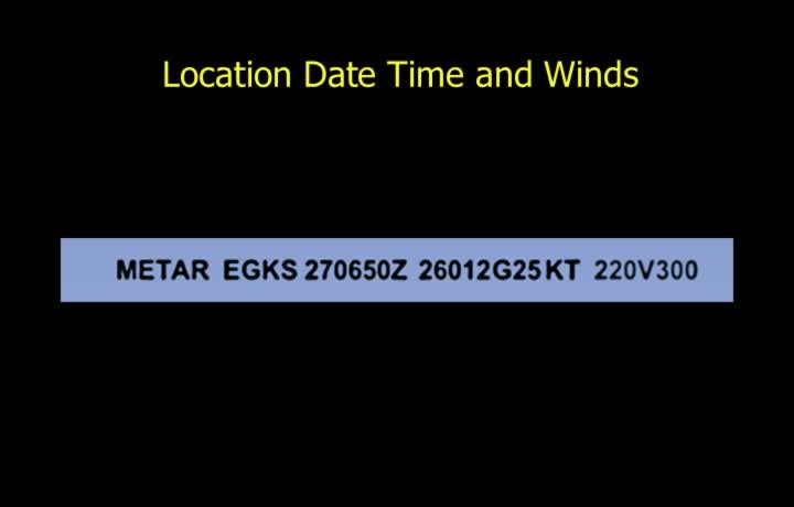
- Report Type and Aerodrome: METAR followed by the ICAO aerodrome indicator (e.g., METAR VIDP).
- Date and Time: Given in UTC (e.g., 270630Z).
- Wind Direction: True wind direction expressed in three digits at 10° intervals.
- Extremes of variable wind direction during the previous 10 minutes are indicated (e.g., 26005KT 220V360).
- Wind Speed: Mean wind speed is reported in knots or metres per second. Gust speed is included when it exceeds the mean speed by 10 knots or more.
- P99 indicates gusts exceeding 99 knots.
Visibility and Runway Visual Range (RVR)
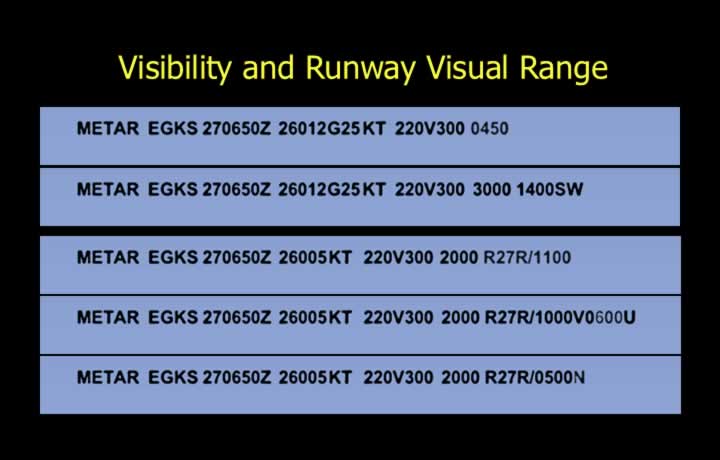
- Visibility: Prevailing visibility over at least half of the aerodrome.
- Visibility up to 10 km is reported in metres. Visibility greater than 10 km is coded as 9999.
- If visibility is lower in a particular direction, it is also reported (e.g., 3000 1400SW).
- Runway Visual Range (RVR): Reported when RVR is less than 1500 m.
- The prefix P indicates a value greater than the reported figure.
- RVR trend is indicated using:
- U – Improving
- D – Deteriorating
- N – No Change
Example: R27R/P1500U
Present Weather
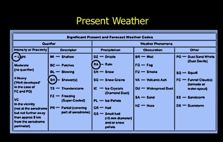
- The present weather group consists of a Qualifier, Descriptor, and Weather Phenomenon.
- The Qualifier indicates intensity and proximity.
- The Descriptor describes the type of precipitation or obscuration.
- The Weather Phenomenon specifies the actual weather condition.
- Example: -SHRA = Light Rain Showers.
Cloud Report
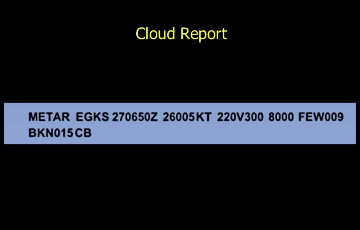
- Cloud height is reported above aerodrome level (QFE) in ascending order of cloud amount.
- FEW = 1–2 oktas.
- SCT = 3–4 oktas.
- BKN = 5–7 oktas.
- OVC = 8 oktas.
- High clouds are reported only when they cover a significant portion of the sky.
- Special cloud types such as CB or TCU are specifically indicated (e.g., FEW009 BKN015 TCU).
Vertical Visibility, Temperature and QNH
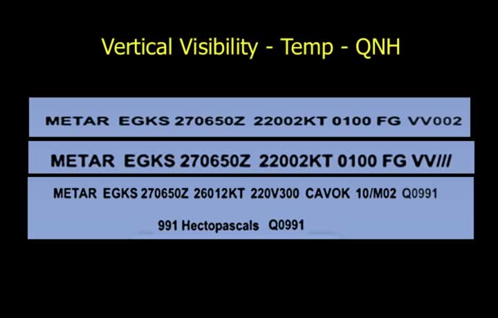
- Vertical Visibility (VV): Reported in hundreds of feet.
- VV002 indicates a vertical visibility of 200 ft.
- If clouds cannot be observed due to obscuration, VV/// is reported.
- Temperature and Dew Point: Reported in whole degrees Celsius.
- Values of 0.5°C are rounded up to the next whole number.
- Negative temperatures are prefixed with M.
- QNH: Reported using the prefix Q (e.g., Q0991) and always rounded down for flight safety.
CAVOK
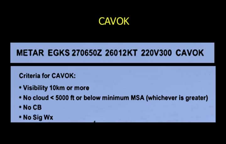
- CAVOK (Ceiling And Visibility OK) may replace visibility, RVR and present weather groups.
- CAVOK Criteria:
- Visibility greater than 10 km.
- No cloud below 5000 ft or the Minimum Sector Altitude (MSA), whichever is higher.
- No Cumulonimbus (CB) clouds.
- No significant weather.
- Minimum Sector Altitude (MSA): Provides at least 300 m (1000 ft) obstacle clearance within a radius of 46 km (25 NM) from a radio navigation aid.
Recent Weather and Wind Shear
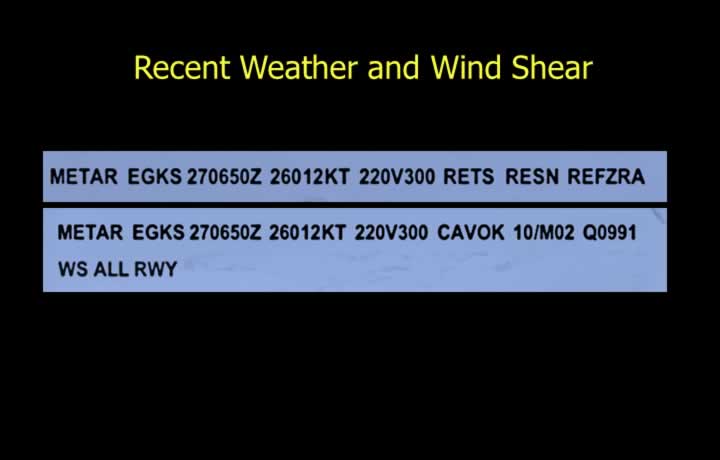
- Recent weather is reported if significant weather occurred during the previous hour or since the last METAR.
- A maximum of three recent weather events may be reported.
- Example: RERA = Recent Rain.
- Wind shear is included when reported by pilots or forecast by meteorological services.
- WS ALL RWY indicates wind shear affecting all runways.
Trend Forecast
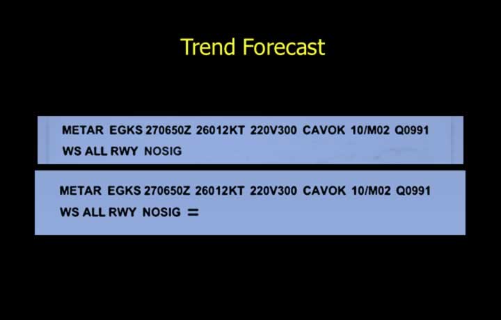
- The trend forecast is valid for 2 hours.
- TAF coding conventions are used in the trend forecast.
- NOSIG indicates that no significant weather changes are expected.
- The report ends with the symbol =.
Runway State
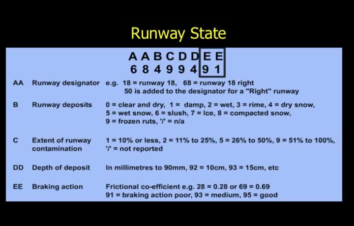
- Runway state (SNOWTAM) is issued for snow-covered runways.
- It includes:
- Runway Designator
- Type of Deposit
- Extent of Coverage
- Depth of Deposit
- Braking Action
- Example: 68 4 9 94 91
Conditions for Issuing SPECI
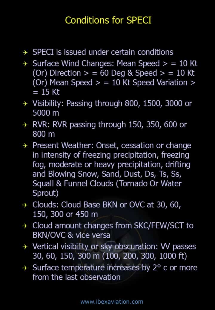
- Surface Wind:
- Mean speed ≥ 10 kt.
- Direction changes by ≥ 60° with speed ≥ 10 kt.
- Mean speed ≥ 10 kt with speed variation ≥ 15 kt.
- Visibility: Passing through 800, 1500, 3000 or 5000 m.
- RVR: Passing through 150, 350, 600 or 800 m.
- Present Weather: Onset, cessation or intensity changes in freezing precipitation, freezing fog, moderate/heavy precipitation, drifting or blowing snow, sand, dust, duststorm (DS), thunderstorm (TS), sandstorm (SS), squalls and funnel clouds (tornado or waterspout).
- Clouds: Cloud base BKN or OVC at 30, 60, 150, 300 or 450 m.
- Cloud amount changes from SKC/FEW/SCT to BKN/OVC or vice versa.
- Vertical Visibility: Passing through 30, 60, 150 or 300 m (100, 200, 500 or 1000 ft).
- Surface temperature changes by 2°C or more since the previous observation.
Special Information
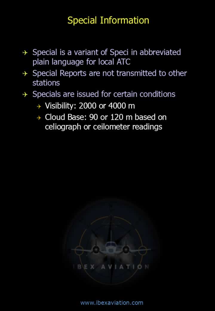
- SPECIAL is an abbreviated plain-language version of SPECI intended for local ATC.
- SPECIAL reports are not transmitted to other stations.
- They are issued for:
- Visibility of 2000 m or 4000 m.
- Cloud base of 90 m or 120 m measured by a ceilometer or celiograph.
Aircraft Reports (AIREP / PIREP)
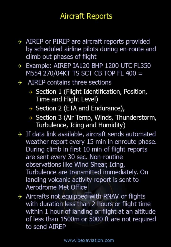
- AIREP or PIREP are weather reports transmitted by pilots during climb and en-route flight.
- Example:
AIREP IA120 BHP 1200 UTC FL350 M554 270/04KT TS SCT CB TOP FL400 = - An AIREP consists of three sections:
- Section 1: Flight identification, position, time and flight level.
- Section 2: Estimated Time of Arrival (ETA) and endurance.
- Section 3: Air temperature, wind, thunderstorms, turbulence, icing and humidity.
- Aircraft equipped with data link automatically transmit weather reports every 15 minutes during cruise.
- During the first 10 minutes of climb, automated reports are transmitted every 30 seconds.
- Non-routine weather such as wind shear, icing and turbulence is transmitted immediately.
- After landing, volcanic activity reports are forwarded to the Aerodrome Meteorological Office when applicable.
- AIREP is generally not required for:
- Aircraft not equipped with RNAV.
- Flights shorter than 2 hours.
- Aircraft within 1 hour of landing.
- Flights below 1500 m (5000 ft).