
Aerodrome Forecast
Aerodrome Weather Forecast
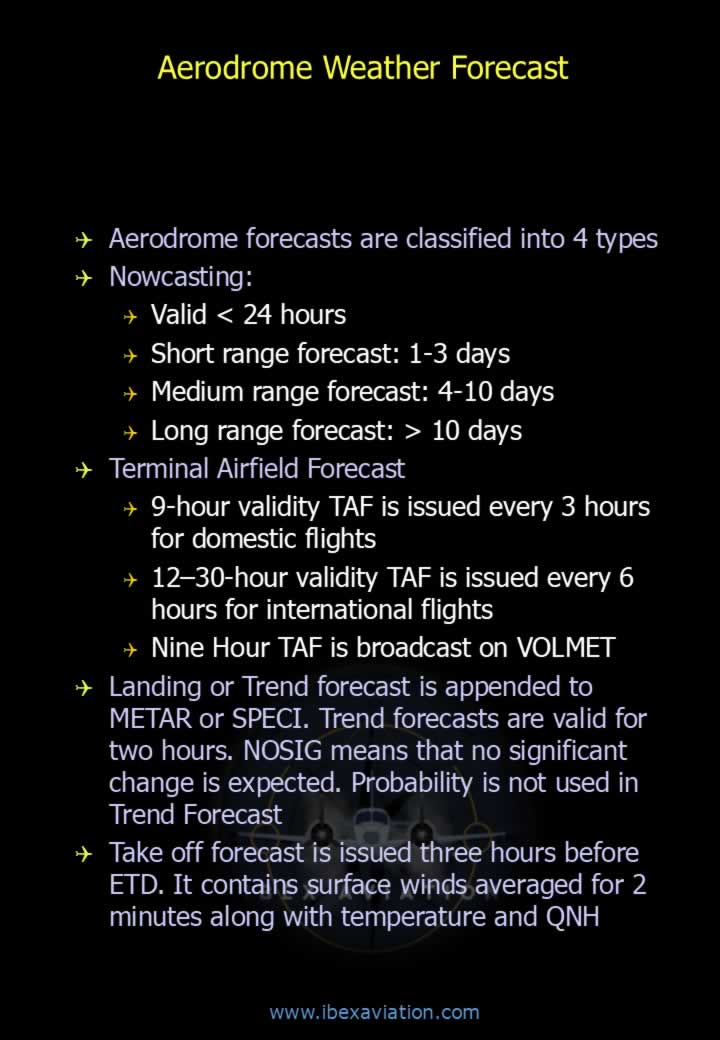
- Aerodrome forecasts are classified into four types:
- Nowcasting: Valid for less than 24 hours.
- Short-Range Forecast: Valid for 1–3 days.
- Medium-Range Forecast: Valid for 4–10 days.
- Long-Range Forecast: Valid for more than 10 days.
- Terminal Aerodrome Forecast (TAF):
- 9-hour validity TAF is issued every 3 hours for domestic flights.
- 12–30 hour validity TAF is issued every 6 hours for international flights.
- 9-hour TAF is broadcast on VOLMET.
- Landing (Trend) Forecast: Appended to METAR or SPECI and valid for 2 hours. NOSIG indicates no significant change is expected. Probability groups are not used in trend forecasts.
- Take-off Forecast: Issued approximately 3 hours before ETD and contains:
- Surface wind averaged over 2 minutes.
- Temperature.
- QNH.
TAF – Time, Wind and Visibility
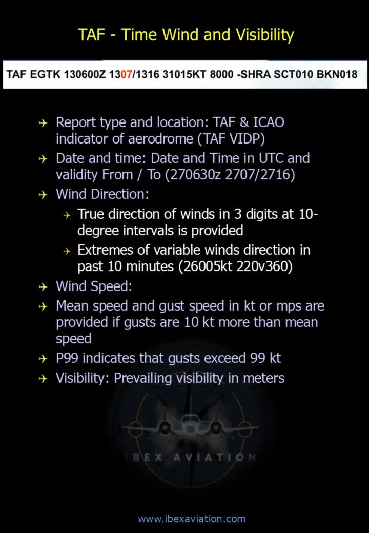
- Report Type and Location: TAF followed by the ICAO aerodrome indicator (e.g., TAF VIDP).
- Date and Time: UTC issue time and validity period (e.g., 270630Z 2707/2716).
- Wind Direction: True direction expressed in three digits at 10° intervals.
- Variable wind extremes may be reported (e.g., 26005KT 220V360).
- Wind Speed: Mean wind speed and gusts (when gusts exceed the mean by 10 kt or more) are reported in knots or metres per second.
- P99 indicates gusts greater than 99 knots.
- Visibility: Prevailing visibility reported in metres.
TAF – Weather and Clouds
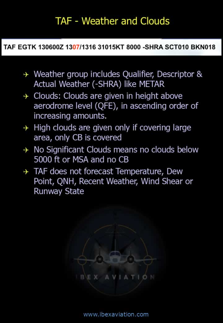
- The weather group contains a Qualifier, Descriptor, and Weather Phenomenon, similar to METAR (e.g., -SHRA).
- Clouds are reported as height above aerodrome level (QFE) in ascending order of cloud amount.
- High clouds are included only when covering a significant area. Only CB (Cumulonimbus) is specifically identified.
- NSC (No Significant Clouds) means:
- No cloud below 5000 ft or the Minimum Sector Altitude (MSA), whichever is higher.
- No Cumulonimbus (CB) clouds.
- TAF does not include forecasts of:
- Temperature.
- Dew Point.
- QNH.
- Recent Weather.
- Wind Shear.
- Runway State.
Temporary and Permanent Changes
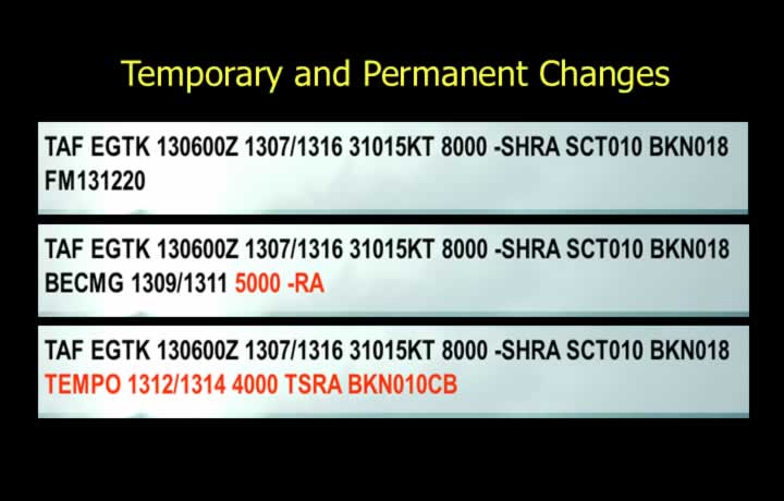
- Permanent Change:
- FM (From): Indicates a permanent change from the specified date and time.
Example:FM271220 27010KT 4000 TSRA BKN010CB - BECMG (Becoming): Indicates gradual change during the specified validity period.
Example:BECMG 1309/1311 4000 TSRA BKN010CB
- FM (From): Indicates a permanent change from the specified date and time.
- Temporary Change:
- TEMPO indicates temporary fluctuations that may occur at any time within the specified period.
- Each fluctuation lasts for less than one hour and occupies less than half of the forecast period.
- Example:
TEMPO 1312/1314 TSRA BKN010CB
Probability and Amended Forecast
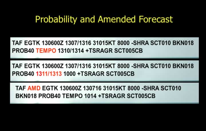
- Probability Groups:
- Probability is expressed as a percentage.
- Example: PROB40 indicates a 40% probability.
- Probability groups may accompany either permanent or temporary changes.
- Amended Forecast: Forecast amendments are indicated using TAF AMD.
Aerodrome Warnings
- Aerodrome warnings are issued for weather conditions likely to adversely affect aircraft on the ground.
- Warnings are generally valid for less than 4 hours.
- Wind Criteria:
- Wind speed greater than 30 kt.
- Wind speed greater than 20 kt with a direction change of at least 45°.
- Weather Warnings: Squall, Tropical Cyclone (TC), Duststorm (DS), Sandstorm (SS), Thunderstorm (TS), Hail (GR), Frost, Snow (SN), Hoar Frost, Rime Ice, Freezing Rain, Sand or Dust Storm, Volcanic Ash (VA), and Tsunami.
- Warnings for gliders, helicopters and light aircraft are issued when surface wind is expected to reach 17 kt or more.
- Wind shear warnings cover the area up to 500 m (1600 ft) above the runway affecting aircraft during approach, take-off, circling approach or while on the runway.
- Wind shear information is also included in METAR, SPECI, and SPECIAL.
Types of Area Forecast
- ARFOR (Area Forecast): Coded or tabular forecast providing:
- Upper winds.
- Upper-air temperatures.
- Significant weather.
- Clouds.
- Freezing level.
- Turbulence.
- Icing.
- Jet stream.
- Tropopause.
- Maximum wind.
- Wind shear.
- Airfield warnings.
- CODAR: Upper-air report from aircraft other than dedicated weather reconnaissance aircraft.
- WINTEM: Forecast of upper-level wind and temperature.
- ROFOR (Route Forecast): Coded route forecast including upper winds, upper-air temperature, significant weather, clouds, freezing level, turbulence, icing, jet stream, tropopause and maximum winds.
- Local Area Forecast:
- Covers a radius of 100 NM.
- Valid for 8 hours.
- Issued three times daily:
- 2130 UTC (Valid 2200–0600 UTC)
- 0530 UTC (Valid 0600–1400 UTC)
- 1330 UTC (Valid 1400–2200 UTC)
- Includes surface wind, visibility, weather, clouds, upper winds, temperature, sunrise, sunset and warnings.
Example of Area and Route Forecast
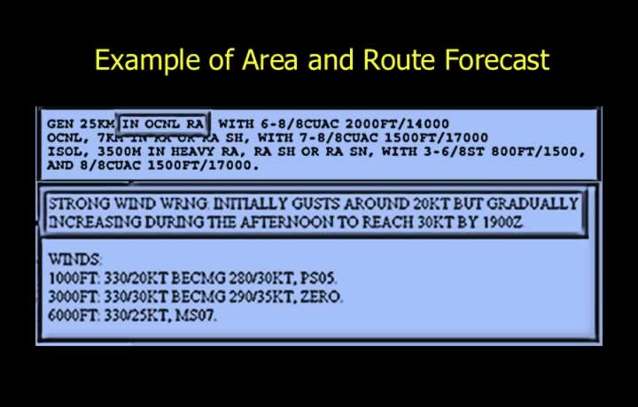
- Area and Route Forecasts are designated as ARFOR and ROFOR.
- ARFOR provides a complete forecast for a geographical area.
- ROFOR provides a forecast for a specified route.
- The overall format of ARFOR and ROFOR is similar.
Comparison Between ARFOR and ROFOR
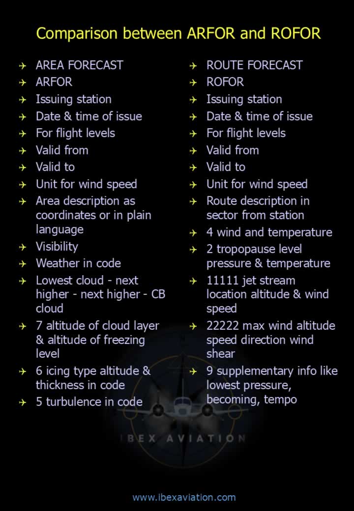
Area Forecast (ARFOR)
- Issuing station.
- Date and time of issue.
- Applicable flight levels.
- Validity period (From / To).
- Wind speed units.
- Area description (coordinates or plain language).
- Visibility.
- Weather in code.
- Cloud layers (lowest to highest including CB).
- Cloud layer altitudes and freezing level.
- Icing type, altitude and thickness.
- Turbulence information.
Route Forecast (ROFOR)
- Issuing station.
- Date and time of issue.
- Applicable flight levels.
- Validity period (From / To).
- Wind speed units.
- Route description divided into sectors.
- Upper wind and temperature.
- Tropopause pressure level and temperature.
- Jet stream location, altitude and wind speed.
- Maximum wind altitude, speed, direction and wind shear.
- Supplementary information such as lowest pressure, BECMG and TEMPO.