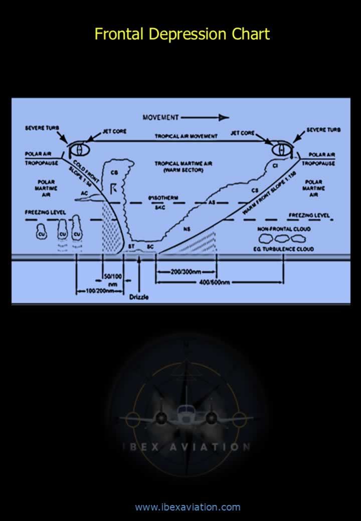
Frontal Depression Weather Pattern
Frontal Depression
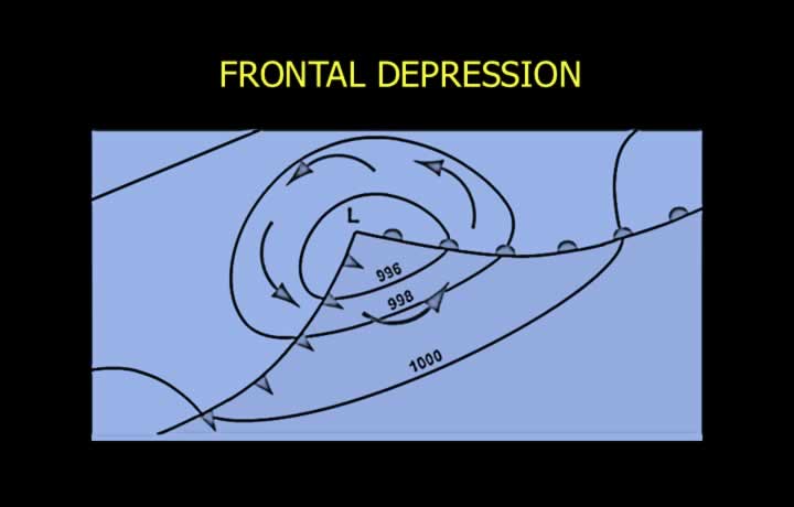
- Ripples or kinks are formed in the front due to varying speeds of movement of air at different places in the front.
- Warm air moves over cool air at higher speed in these kinks. Coriolis force further rotates the air anticlockwise in the Northern Hemisphere.
- Low pressure in the warm sector between the warm and cold front causes a rotational flow.
- Pressure falls further due to warm and less dense air at higher levels, causing a chain reaction.
- Low pressure further induces rotation of air and pushes more air over cool air, resulting in a secondary cold front. Pressure falls further, increasing the intensity of the low pressure.
Clouds in Frontal Depression
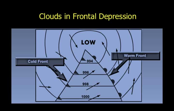
- Uplift of air in both cold and warm fronts causes vertical and layered clouds.
- The lowest pressure or depression can be found in the warm sector.
- Convergence near fronts increases uplift of air, resulting in vertically growing clouds like Cumulus and Cumulonimbus clouds.
Weather in Warm Front
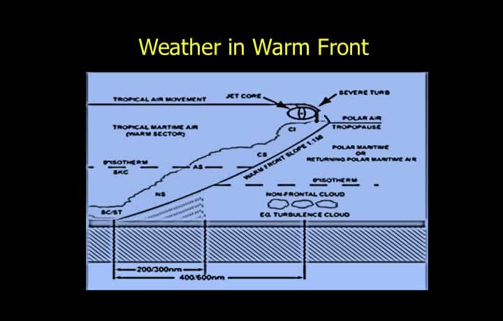
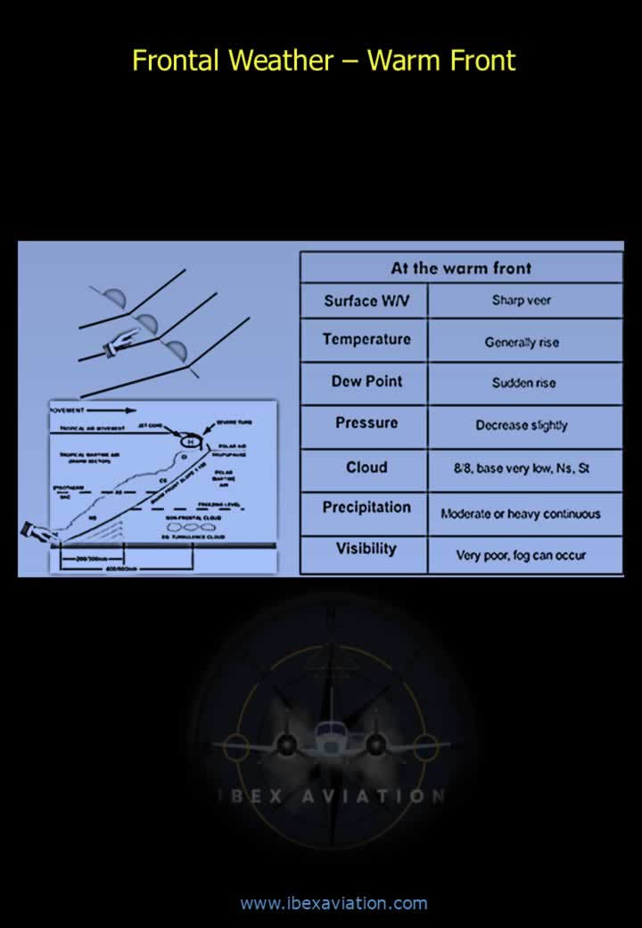
- Warm air rises over the cold air in the warm front with a slope of 1:150.
- Forms stratiform type clouds, reducing in height from high-level clouds like Cirrus to lower-level clouds like Stratus.
- Cloud sequence: CI – CS – AS – NS – SC – ST
- Winds back (change in an anticlockwise direction) by about 30° and increase in speed.
- After passage of the front, winds veer (change clockwise) by about 30° and reduce in speed.
- Visibility is good outside precipitation.
- Snow or rime ice can be expected in a warm front.
- Jet streams flow parallel to the front at right angles (imagine them coming out of the screen).
Weather in the Warm Sector
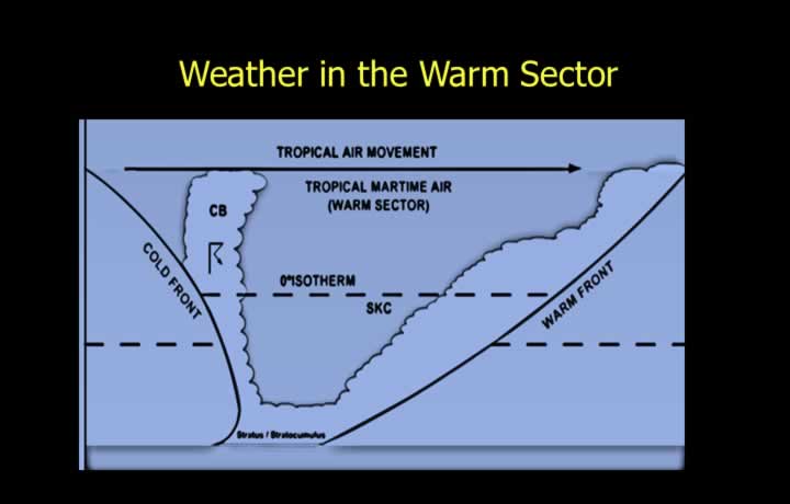
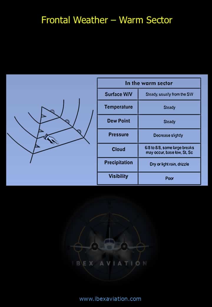
- Low pressure is found in the warm sector that lies between the cold and warm fronts.
- The warm sector is a stable air mass found after the passage of the warm front.
- Low-level Stratus and Stratocumulus clouds can be expected.
- Advection fog may reduce visibility due to warm air flowing over cold air.
- Wind speeds are generally steady and not gusty in this sector.
Weather in Cold Front
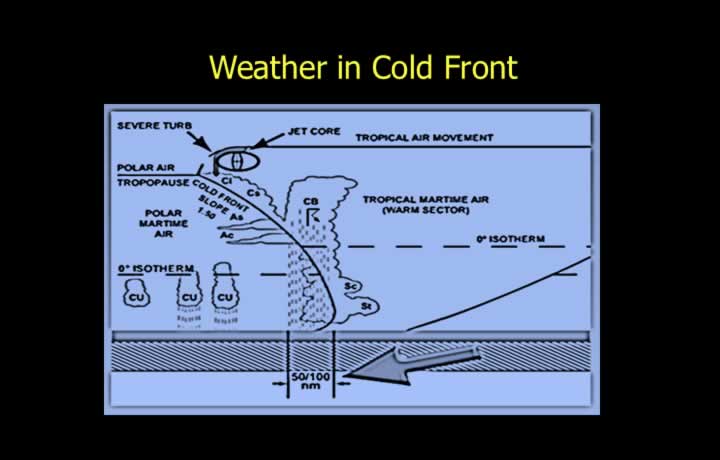
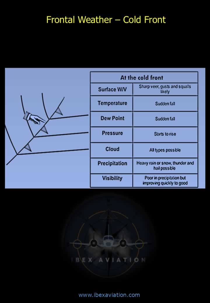
- Cold air undercuts the warm air mass with a steep slope of 1:50.
- Violent weather can be expected from 50–100 NM behind the cold front.
- Clouds change from low-level Stratus to Cirrocumulus.
- Cloud sequence: ST – SC – AS – AC – CT – CC
- The 0°C isotherm is found at lower levels, resulting in lower freezing levels.
- Severe icing can be expected in a cold front.
- Jet stream is at right angles and appears to go into the screen along the front.
Weather After the Cold Front
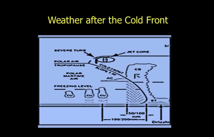
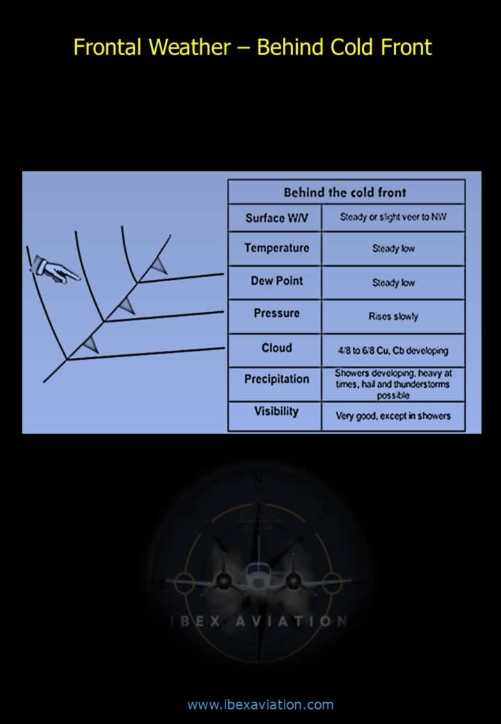
- After the passage of the cold front, the air becomes cool, dry, and unstable.
- Some Cumulus clouds with rain or showers may occur.
- Moderate turbulence and icing can be expected after the cold front.
Speed of Frontal Movement
- The lifespan of a frontal depression varies between 4 and 10 days.
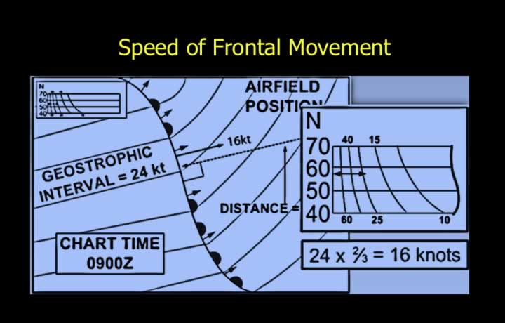
- It moves in the direction of the isobars at a speed calculated using the geostrophic wind scale.
- The isobaric scale on pressure charts provides the geostrophic wind scale.
- The speed of frontal movement is approximately two-thirds of the geostrophic wind speed.
- Speed of Frontal Movement = (Geostrophic Wind Speed × 2) / 3
Occluded Front
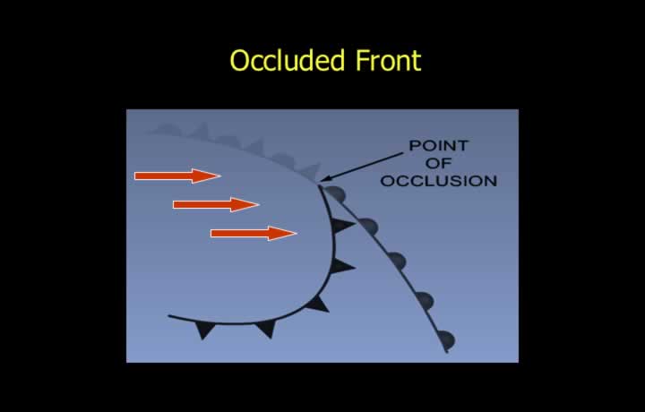
- An occluded front is created when a cold front follows a warm front.
- The cold front generally moves at about twice the speed of the warm front and eventually catches up.
- As the cold front catches the warm front, an occluded front forms progressively.
- The meeting point of the warm and cold fronts marks the beginning of the occluded front.
- Severe weather can be expected in an occluded front while the warm sector reduces progressively.
Cold and Warm Occlusion
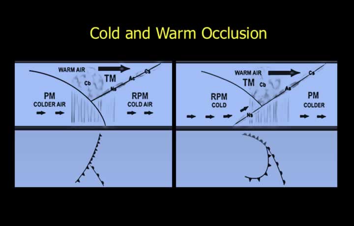
- Cold Occlusion: Occurs when the air in the cold front is colder than the cool air behind the warm front, causing it to undercut the air behind the warm front.
- Weather sequence in a cold occlusion: warm front weather followed by cold front weather.
- Warm Occlusion: Occurs when the air in the cold front is warmer than the cool air behind the warm front.
- The cold front overrides the warm front ahead, producing warm front weather.
- Back-bent occlusion may cause thundery and snowy weather.
Fronts Across the Globe
- Stationary Front: Remains stationary with contrasting air masses on either side, resulting in winds flowing parallel to the frontal boundary.
- Polar Front: Found around 60° latitude between polar easterlies and mid-latitude westerlies.
- Polar fronts are not continuous and remain active only in certain segments.
- Arctic Front: Found between Arctic and Polar air masses, north of the Polar Front.
- During winter, the Arctic Front may descend into the temperate latitudes.
- Mediterranean Front: Found over the Mediterranean region between Polar Continental air from Europe and Tropical Continental air from North Africa.
Frontal Weather – Ahead of Warm Front
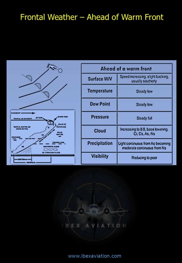
Frontal Weather – Warm Front
Frontal Weather – Warm Sector
Frontal Weather – Cold Front
Frontal Weather – Behind Cold Front
Frontal Depression Chart