
Significant Met Information
SIGMET, AIRMET and GAMET
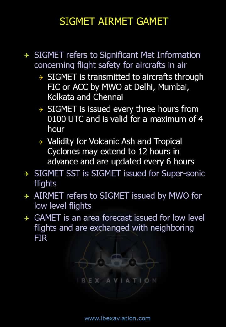
- SIGMET (Significant Meteorological Information) contains weather information significant to the safety of aircraft in flight.
- In India, SIGMET is issued by the Meteorological Watch Office (MWO) and transmitted to aircraft through the Flight Information Centre (FIC) or Area Control Centre (ACC) at Delhi, Mumbai, Kolkata and Chennai.
- SIGMET is issued every 3 hours starting from 0100 UTC and is valid for a maximum of 4 hours.
- For Volcanic Ash and Tropical Cyclones, validity may extend up to 12 hours, with updates issued every 6 hours.
- SIGMET SST is a SIGMET issued specifically for supersonic flights.
- AIRMET is a SIGMET intended for low-level flights.
- GAMET is an area forecast issued for low-level flights and exchanged between neighbouring Flight Information Regions (FIRs).
Conditions for Significant Meteorological Information (SIGMET)
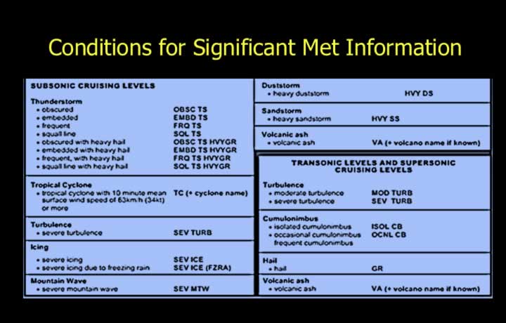
- SIGMET is issued for the following significant weather phenomena:
- Thunderstorms:
- OBSC TS – Obscured Thunderstorm
- FRQ TS – Frequent Thunderstorms
- EMBD TS – Embedded Thunderstorms
- SQL TS – Squall Line Thunderstorms
- TSGR – Thunderstorms with Hail
- Tropical Cyclones with sustained winds greater than 34 knots for at least 10 minutes.
- Severe turbulence caused by strong winds or rotor clouds.
- Severe icing outside convective clouds or due to freezing rain.
- Severe mountain waves with updrafts exceeding 3 m/s accompanied by severe turbulence.
- Heavy dust storms or sandstorms.
- Volcanic ash.
- Radioactive cloud.
SIGMET Format
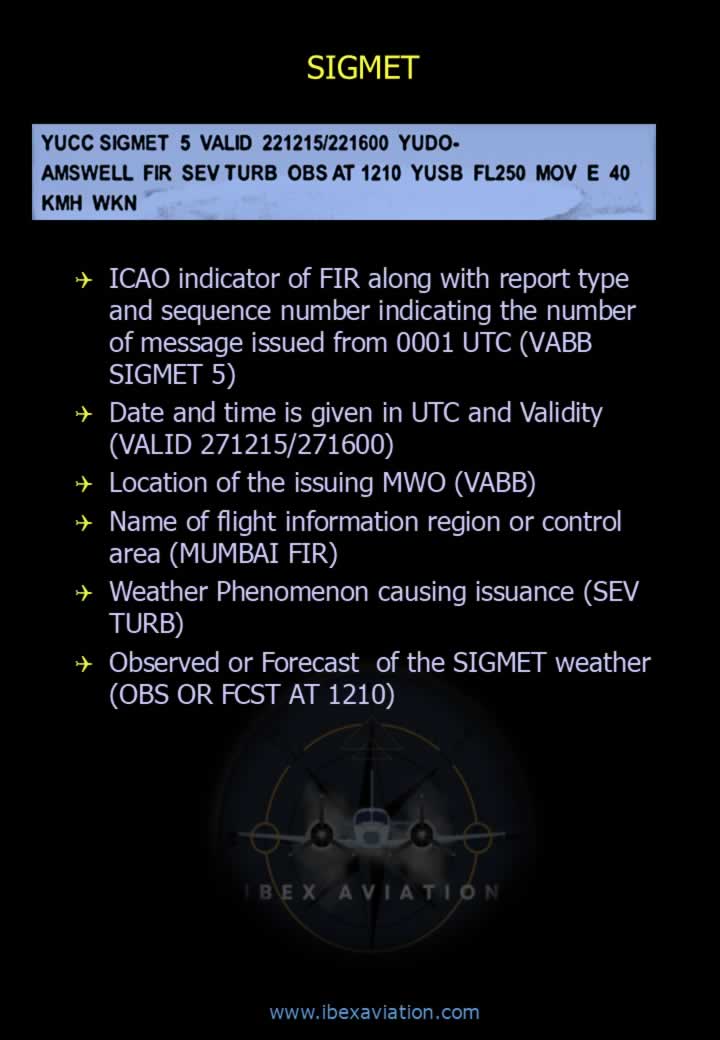
- ICAO indicator of the FIR, report type and sequence number (e.g., VABB SIGMET 5).
- Date, time and validity period in UTC (e.g., VALID 271215/271600).
- Location of the issuing Meteorological Watch Office (MWO).
- Name of the Flight Information Region (FIR) or Control Area.
- Weather phenomenon responsible for the SIGMET (e.g., SEV TURB).
- Whether the phenomenon is Observed (OBS) or Forecast (FCST), together with the observation or forecast time.
SIGMET Position and Movement
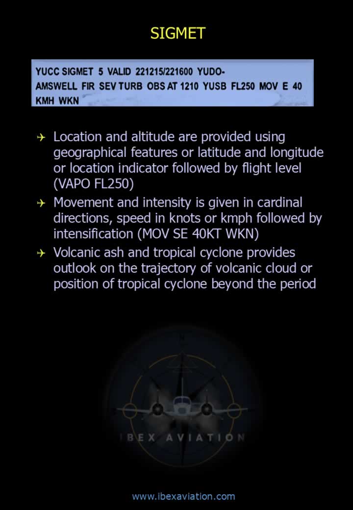
- Location and altitude are reported using geographical features, latitude/longitude, or location indicators followed by flight level (e.g., VAPO FL250).
- Movement is described using cardinal directions and speed in knots or km/h, followed by intensity trend.
- Example: MOV SE 40KT WKN (Moving southeast at 40 knots and weakening).
- Volcanic ash and tropical cyclone SIGMETs include an outlook showing the expected future position beyond the validity period.
SIGMET Decode
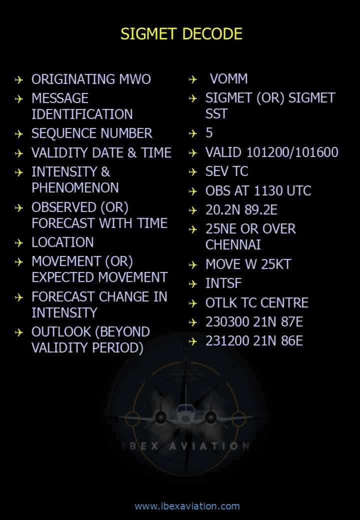
- Originating Meteorological Watch Office (MWO).
- Message identification.
- Sequence number.
- Validity date and time.
- Intensity and weather phenomenon.
- Observed or forecast time.
- Location.
- Movement or expected movement.
- Forecast change in intensity.
- Outlook beyond the validity period.
Example SIGMET
VOMM
SIGMET 5
VALID 101200/101600
SEV TC
OBS AT 1130 UTC
20.2N 89.2E
25 NM NE OF CHENNAI
MOV W 25KT
INTSF
OTLK TC CENTRE
230300 21N 87E
231200 21N 86E
AIRMET Format
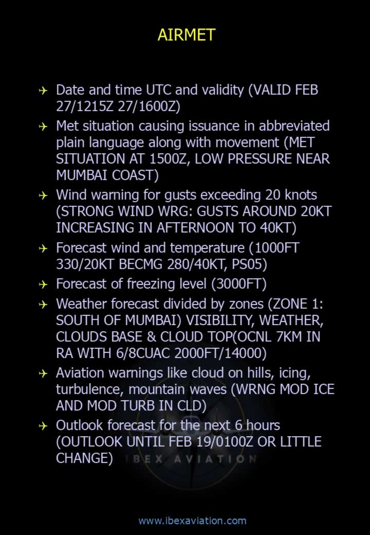
- Date, time and validity period in UTC (e.g., VALID FEB 27/1215Z 27/1600Z).
- Meteorological situation causing issuance, written in abbreviated plain language together with movement.
- Example: MET SITUATION AT 1500Z, LOW PRESSURE NEAR MUMBAI COAST.
- Wind warning for gusts exceeding 20 knots.
- Forecast wind and temperature.
- Forecast freezing level.
- Weather forecast divided into geographical zones.
- Each zone includes:
- Visibility.
- Weather.
- Cloud base and cloud tops.
- Aviation warnings such as:
- Cloud on hills.
- Icing.
- Turbulence.
- Mountain waves.
- Outlook forecast valid for the following 6 hours.
AIRMET Decode
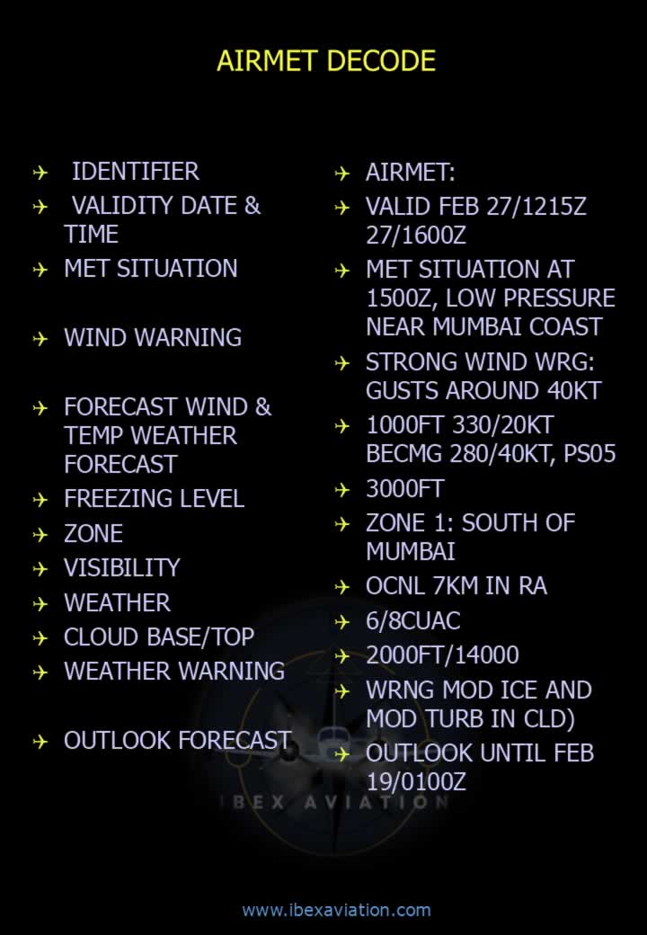
- Identifier.
- Validity date and time.
- Meteorological situation.
- Wind warning.
- Forecast wind and temperature.
- Freezing level.
- Forecast zone.
- Visibility.
- Weather.
- Cloud base and cloud top.
- Weather warning.
- Outlook forecast.
Example AIRMET
AIRMET
VALID FEB 27/1215Z 27/1600Z
MET SITUATION AT 1500Z, LOW PRESSURE NEAR MUMBAI COAST
STRONG WIND WRG: GUSTS AROUND 40KT
1000FT 330/20KT BECMG 280/40KT PS05
FREEZING LEVEL 3000FT
ZONE 1: SOUTH OF MUMBAI
OCNL 7KM IN RA
6/8 CU/AC
2000FT/14000FT
WRNG MOD ICE AND MOD TURB IN CLD
OUTLOOK UNTIL FEB 19/0100Z