
Air Mass and Fronts
Air Mass
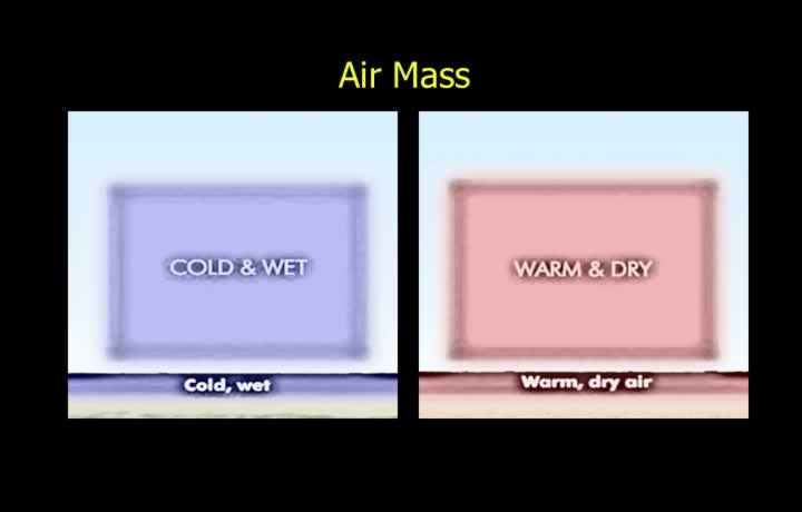
- An air mass is a large body of air with a nearly uniform distribution of temperature, density, and humidity.
- Air masses cover thousands of square kilometres, and their characteristics depend on their source region.
- They form when air remains stagnant over a source region for an extended period.
- For example, an air mass that remains over Arctic ice develops extremely cold characteristics.
Formation of Air Masses
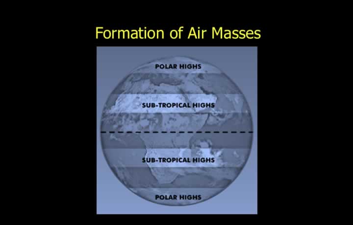
- Air masses form under stable atmospheric conditions associated with high pressure and light winds.
- Polar and subtropical high-pressure regions are the ideal source regions for air mass formation.
- As an air mass moves away from its source region, it carries its original characteristics with it.
Modification of Air Masses During Movement
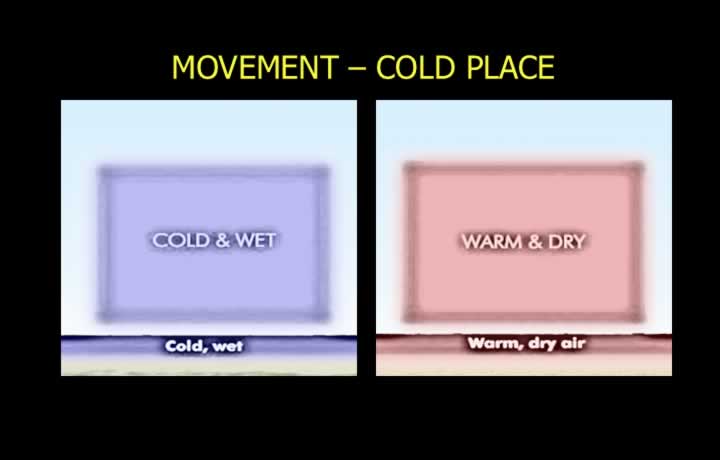
- As air masses move with the prevailing winds, their lower layers are modified by the underlying surface.
- When a cold air mass moves over a warmer surface, the lower layers warm up, become unstable, and the relative humidity decreases.
- When a warm air mass moves over a colder surface, the lower layers cool, become more stable, and the relative humidity increases.
Types of Air Masses
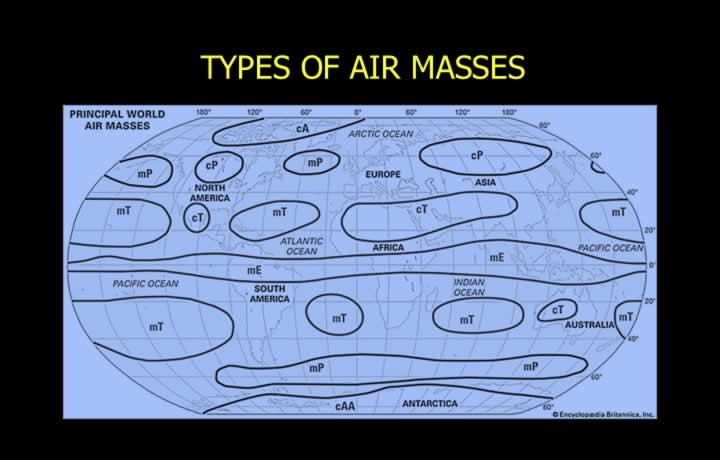
- Arctic (A): Forms over the Arctic region; extremely cold and dry.
- Polar Continental (Pc): Forms over polar land areas; cold and dry.
- Polar Maritime (Pm): Forms over polar oceans; cold and moist.
- Tropical Maritime (Tm): Forms over tropical oceans; warm and humid.
- Tropical Continental (Tc): Forms over tropical land areas; very hot and dry.
- Equatorial Maritime (Em): Forms over equatorial oceans; extremely hot and humid.
Fronts
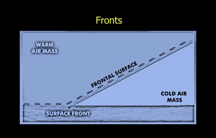
- A front is a narrow transition zone between two air masses having different temperatures and densities.
- The passage of a front causes significant changes in temperature, wind, cloud cover, and precipitation.
- The frontal surface is the three-dimensional sloping boundary separating two air masses.
- The line where the frontal surface intersects the Earth’s surface is called the front.
Frontogenesis and Frontolysis
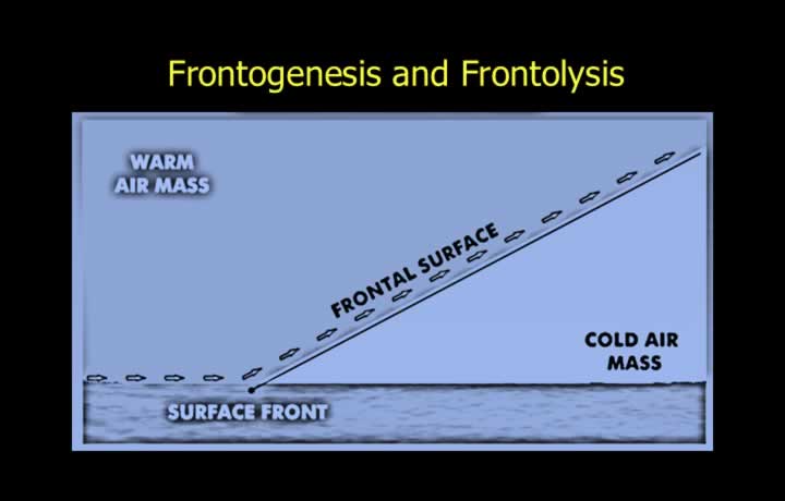
- Frontogenesis is the process of formation and strengthening of a front.
- Increasing frontal activity indicates increasing temperature and density contrast between air masses.
- Frontolysis is the weakening and eventual dissipation of a front as frontal activity decreases.
Semi-Permanent Fronts
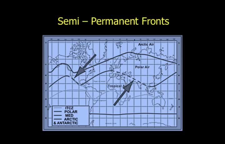
- Semi-permanent fronts exist throughout the year but shift position or weaken slightly with the seasons.
- Examples include:
- Polar Front
- Arctic Front
- Inter-tropical Convergence Zone (ITCZ)
- Mediterranean Front
Warm and Cold Fronts
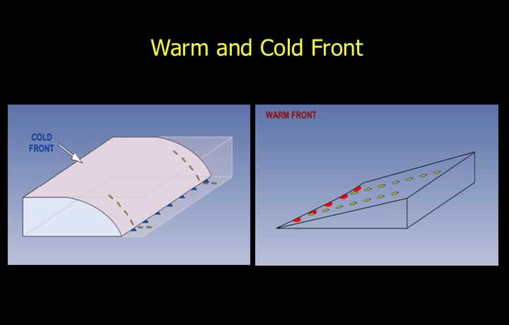
- A Cold Front forms when a cold air mass advances and overtakes a warm air mass.
- Being denser, the cold air undercuts the warm air, creating a wedge-shaped frontal surface.
- A Warm Front forms when a warm air mass advances over a retreating cold air mass.
- The lighter warm air glides upward over the colder air along a gently sloping frontal surface.
Cold Front
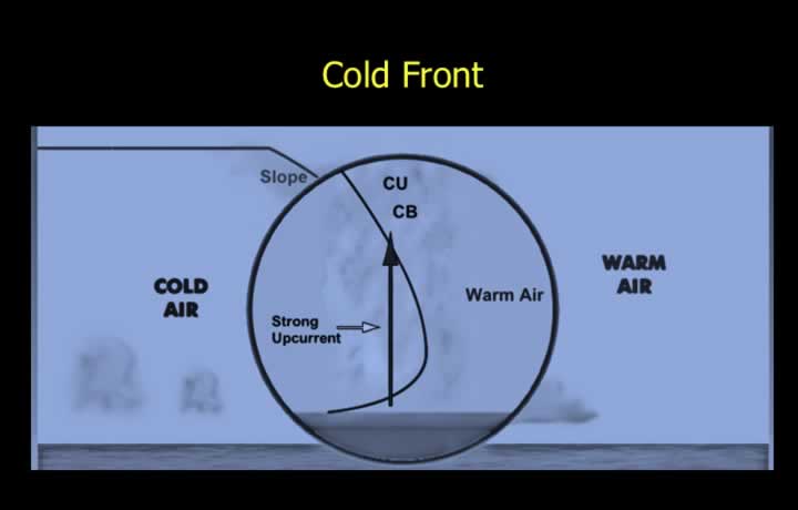
- Cold air advances beneath warm air, forcing the warm air to rise rapidly.
- The unstable conditions produce vertically developed clouds such as Cumulus (Cu) and Cumulonimbus (Cb).
- A typical cold front has a slope of approximately 1:80.
- For every 1 km of vertical rise, the frontal surface extends about 80 km horizontally.
- Heavy rain, snow, severe turbulence, and icing are common.
- Visibility is generally good outside cloud and precipitation areas.
Kata Type Cold Front
- A Kata cold front is comparatively shallow.
- Typical slope: 1:120.
- Typical movement: approximately 20 knots.
- Clouds may include Stratus (St), Nimbostratus (Ns), Altostratus (As), Cumulus (Cu), and Cumulonimbus (Cb).
- Showery precipitation occurs ahead of and immediately behind the front.
- Behind the front, precipitation is mainly associated with Ns and As clouds.
- Fast-moving fronts may develop Squall Lines consisting of Cumulonimbus clouds.
Ana Type Cold Front
- An Ana cold front is steeper than a Kata cold front.
- The frontal slope ranges from 1:50 to 1:80.
- The steep slope produces vigorous uplift resulting in thunderstorms, hail, and extensive Cu and Cb development.
- Typically extends over 100–150 km and moves at speeds exceeding 30 knots.
- Skies usually clear rapidly after frontal passage.
Warm Front
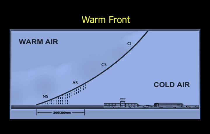
- Warm air gradually overruns colder air along a gentle slope.
- The frontal slope typically ranges from 1:150 to 1:180.
- Typical movement is 10–15 knots.
- Clouds lower progressively from Cirrostratus (Cs) to Altostratus (As), Nimbostratus (Ns), and Stratus (St).
- Intermittent precipitation may extend up to 600 NM ahead of the front.
- Light icing, light turbulence, frontal fog, and poor visibility are common.
- Icing intensity may increase over mountainous terrain due to lower freezing levels.
Kata Type Warm Front
- A Kata warm front has a gentle slope and stable air.
- High-level clouds such as Cirrus (Ci) and Cirrostratus (Cs) may appear approximately 1,000 km ahead of the front.
- Medium-level clouds such as Altostratus (As) and Nimbostratus (Ns) appear roughly 500 km ahead.
- Persistent precipitation occurs over a broad area.
- Frontal fog and low clouds reduce visibility immediately ahead of the front.
Ana Type Warm Front
- An Ana warm front has a comparatively steeper slope with slightly unstable air.
- Embedded Cumulus (Cu) and Cumulonimbus (Cb) clouds may develop within middle-level stratiform clouds.
- Brief periods of heavy precipitation are common near the frontal zone.
- Fog or drizzle from Stratus clouds ahead of the front reduces visibility.
Air Masses Affecting India During Winter
- During winter, cold and dry Tropical Continental (Tc) air originating from the Siberian high-pressure region influences India.
- Tropical Continental air dominates North India, while Equatorial Maritime (Em) air affects South India.
- Western Disturbances (WD) draw moisture from Equatorial Maritime air over the Arabian Sea, producing widespread precipitation across North India.
- After the passage of a Western Disturbance, Polar Continental (Pc) air often produces cold-wave conditions over North India.
Air Masses Affecting India During Summer
- During the Southwest monsoon, warm, humid Tropical Maritime (Tm) air originating over the North Pacific reaches India through Southeast Asia.
- Warm, moist Equatorial Maritime (Em) air from the Indian Ocean also reaches India after an extended passage over the sea.
- The Monsoon Trough (Equatorial Low) develops over the Indo-Gangetic Plains along the Ganges.
- Northwest of the trough lies Tropical Continental (Tc) air.
- Northeast of the trough is dominated by Tropical Maritime (Tm) air.
- South of the trough, warm and humid Equatorial Maritime (Em) air predominates.