
Cloud Development
Dew Point and Lifting Condensation Level
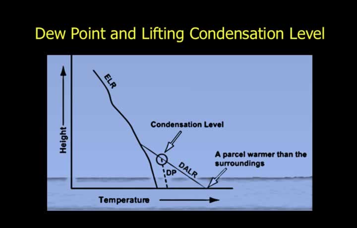
- Clouds are aggregates of visible water droplets or ice particles formed and sustained by the adiabatic lifting and cooling of air until saturation, followed by condensation or deposition.
- Dew point is the temperature at which an air parcel, when lifted adiabatically, becomes saturated and water vapour condenses into water droplets.
- Lifting Condensation Level (LCL) is the height at which cloud formation begins due to condensation at the dew point.
- The Lifting Condensation Level indicates the cloud base of convective clouds.
Temperature and Dew Point
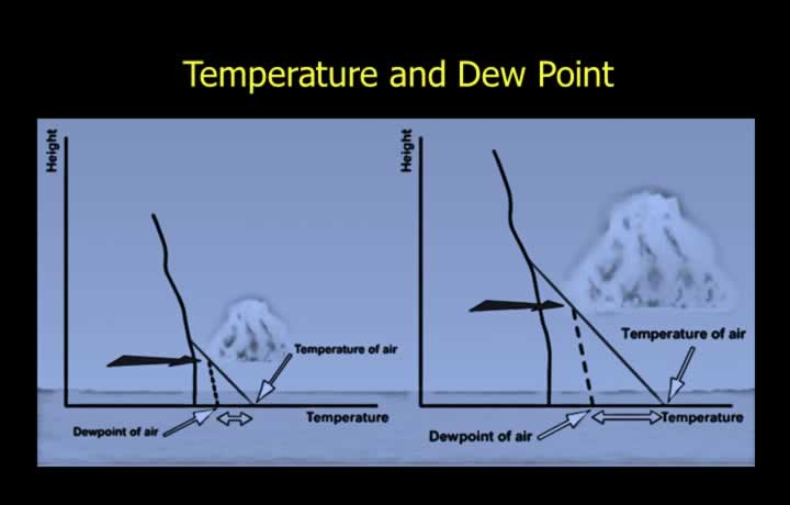
- Cloud base can be approximated by the difference between the surface temperature and the dew point.
- A larger difference between surface temperature and dew point indicates a higher cloud base.
- Cloud Base (ft) = (Surface Temperature − Dew Point) × 400
- High surface temperatures generally produce higher cloud bases and higher cloud tops, especially around 1500 LMT, due to intense surface heating.
Top of Vertically Growing Clouds
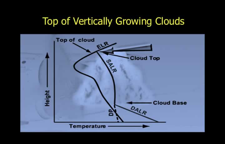
- A cloud stops growing vertically when there is a sharp reduction in relative humidity.
- Humidity levels are measured using a radiosonde and plotted on a thermodynamic graph.
- The height at which the SALR curve meets the ELR curve indicates an inversion layer.
- At the inversion layer, the saturated air parcel is no longer warmer than the surrounding environment and therefore stops rising.
- This height generally represents the cloud top of a Cumulonimbus (Cb) cloud.
Layered Clouds
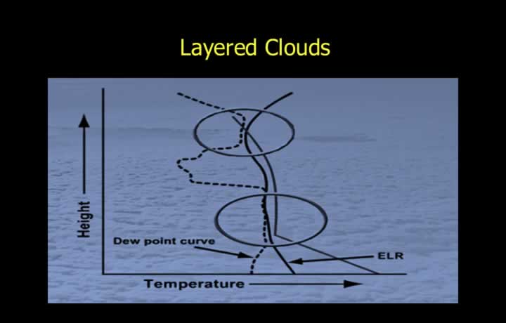
- Layered clouds form at heights where the ELR curve meets the Dew Point curve on a height-temperature graph.
- These clouds may be Stratocumulus (Sc) or Altostratus (As).
- Wind-induced turbulent mixing carries moisture to the top of the mixing layer, just below the inversion layer, producing layered clouds.
- Surface friction caused by hills and buildings forces air to rise, often producing small cumuliform clouds over built-up areas.
Trigger Temperature
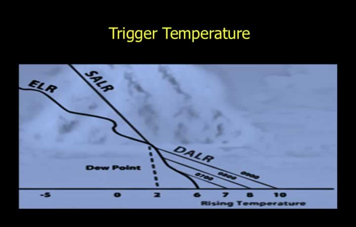
- Cumuliform clouds form due to localized or large-scale vertical motion of air caused by surface heating.
- Trigger Temperature is the surface temperature at which the atmosphere becomes warm enough for an air parcel to rise to the Lifting Condensation Level and cool to its dew point.
- Below the trigger temperature, the air parcel reaches the environmental temperature before reaching the dew point and therefore does not become saturated or form clouds.
Convergence and Divergence
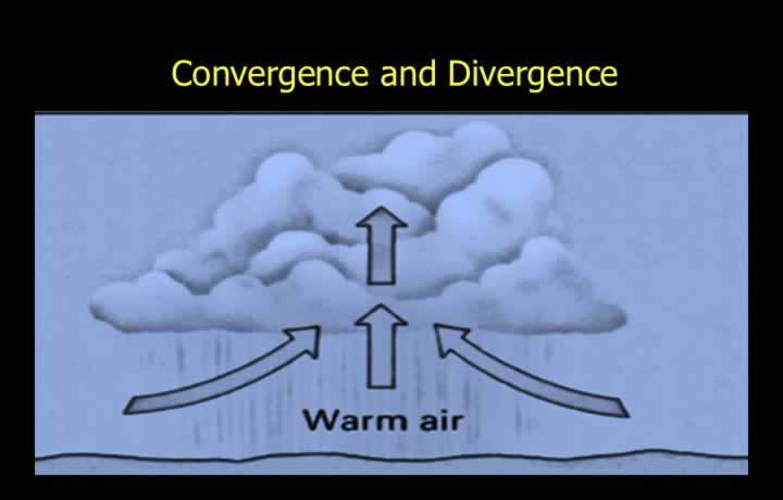
- Velocity convergence refers to the net horizontal inflow of air.
- Accumulated air rises at the surface and may produce either ascent or descent at higher levels.
- Air converges in areas of low pressure, cyclones and depressions.
- Velocity divergence refers to the net horizontal outflow of air.
- Air generally diverges from high-pressure areas and anticyclonic circulations.
Convergence Due to Sea Breeze
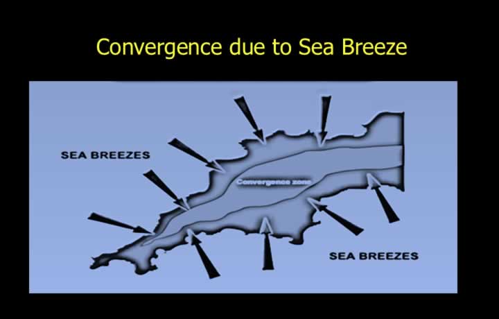
- Convergence is the accumulation of air caused by inflow from the surrounding areas.
- The converging air is forced to rise because of the accumulation of air at a point or along a line.
- On islands and peninsulas, sea breezes from different directions converge, causing strong upward motion and the formation of cumulus clouds.
Convergence Due to Low-Pressure Systems
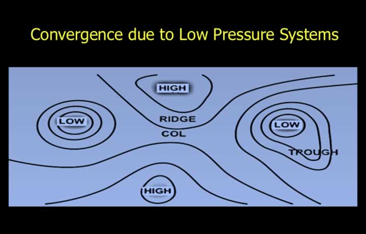
- Large-scale low-pressure systems draw air from surrounding high-pressure areas.
- This convergence forces air to rise, resulting in the development of vertically growing clouds.
Frontal Convergence
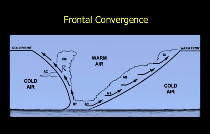
- Frontal zones provide sloping surfaces that promote convergence.
- Warm air rises over colder air along warm, cold and occluded fronts.
- The ascending air along frontal surfaces cools and produces cloud formation.
Orographic Ascent of Air
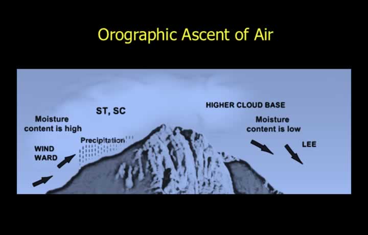
- Orographic ascent refers to the forced lifting of air over mountainous terrain, especially along coastlines.
- Moist air forced to rise over coastal mountains cools adiabatically, producing clouds and precipitation on the windward slopes.
- The presence of lenticular clouds over mountains indicates turbulence and an increased risk of icing.
Contrails and Distrails
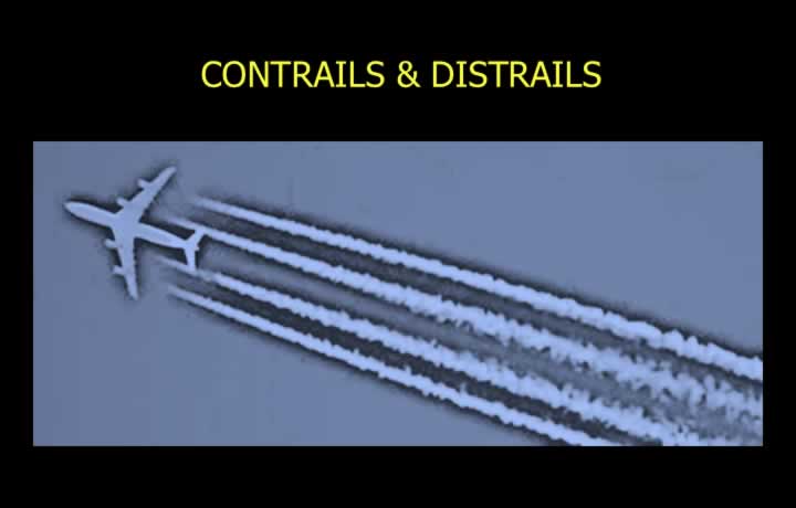
- Contrails are condensation trails produced due to aerodynamic pressure reduction around wingtips, causing condensation of atmospheric moisture.
- Exhaust trails form when water vapour from aircraft engines condenses at high altitudes, typically above the freezing level (around 9 km).
- Distrails occur when the heat from aircraft exhaust evaporates cloud droplets, creating clear paths through clouds.
- Mintra Level is the altitude below which contrails cannot form.
- Drytra Level is the altitude at which contrails can form solely from exhaust moisture, even when the relative humidity is zero.