Grid Navigation
Grid Navigation is a method of navigation using a grid system of lines on a map or chart. It helps pilots identify positions, directions, and routes accurately. Grid references are used for efficient flight planning and navigation over large areas.
Introduction to Grid Navigation
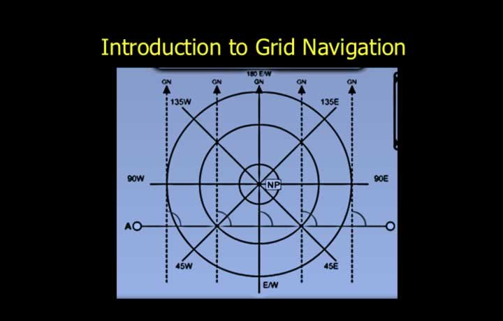
- True and magnetic directions become unreliable at high latitudes for three main reasons:
- Rapid meridian convergence causes true tracks to change quickly.
- Magnetic variation is large and changes considerably with position.
- The magnetic compass becomes unreliable because of the weak horizontal component of the Earth’s magnetic field.
- Grid navigation overcomes these problems in polar and high-latitude regions.
- It significantly reduces steering difficulties during navigation.
Grid Charts
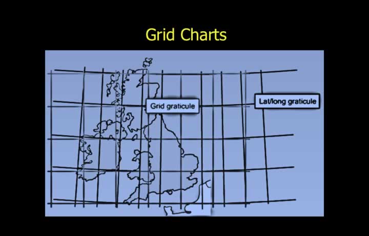
- Grid charts use a square grid instead of latitude and longitude graticules.
- They are primarily used for navigation in high-latitude and polar regions.
- A grid chart is constructed by selecting a datum meridian.
- The Greenwich Meridian is commonly chosen as the datum meridian.
- All other grid meridians are drawn parallel to the datum meridian.
Grid Convergence
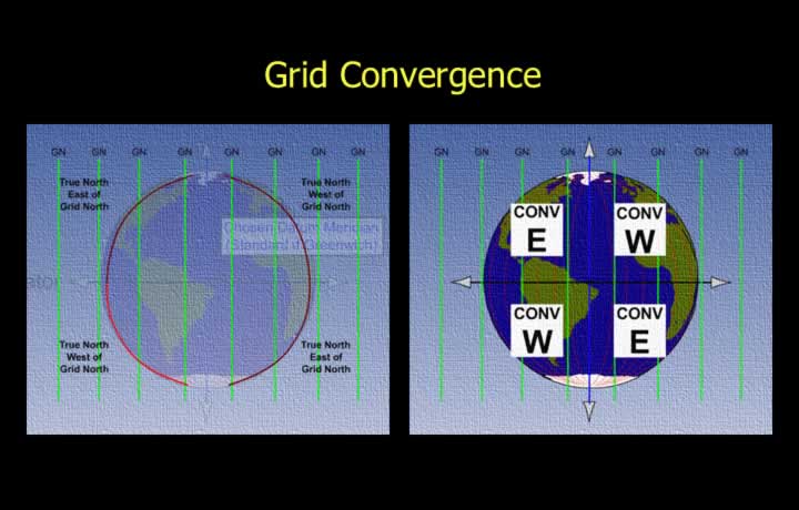
- On a grid chart, convergence may be expressed as:
- The angular difference between True North and Grid North.
- The angular difference between the local meridian and the datum meridian.
Grid Convergence in the Northern and Southern Hemispheres
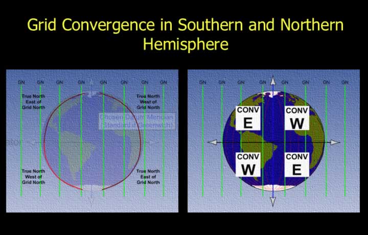
- Southern Hemisphere:
- Grid convergence has the same sense as the orientation of the local meridian.
- Convergence is West if the local meridian lies west of the datum meridian.
- Convergence is East if the local meridian lies east of the datum meridian.
- Northern Hemisphere:
- Grid convergence is opposite to the orientation of the local meridian.
- Convergence is East if the local meridian lies west of the datum meridian.
- Convergence is West if the local meridian lies east of the datum meridian.
Standard Polar Grid Chart
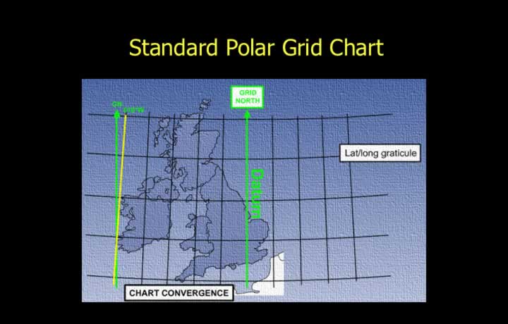
- A standard polar grid chart normally uses the Greenwich Meridian as the datum meridian.
- Isogrivs are lines joining places of equal grivation.
- Grid convergence is the angular difference between True North and Grid North.
- Grid navigation is based on the principle of grid convergence.
Chart Convergence
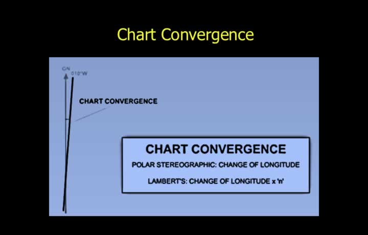
- Chart convergence on grid charts follows the same principles as other chart projections.
- For Lambert Conformal Conic grid charts:
- Chart Convergence = Change in Longitude × Constant of Cone
- For Polar Stereographic grid charts:
- Chart Convergence = Change in Longitude
Convergence
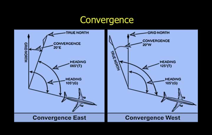
- Convergence depends on the relative positions of True North and Grid North.
- Convergence is East when True North lies east of Grid North.
- Convergence is West when True North lies west of Grid North.
- To convert a grid direction to a true direction:
- If convergence is East, True = Grid − Convergence (“East is Least”).
- If convergence is West, True = Grid + Convergence (“West is Best”).
Grid Steering Using a Magnetic Compass
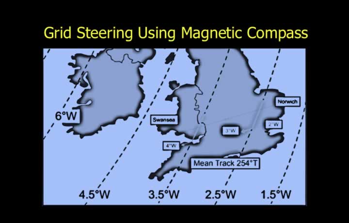
- Grivation is used to convert grid tracks directly to magnetic tracks.
- Grivation is the algebraic sum of Grid Convergence and Magnetic Variation.
- Grid steering using a magnetic compass is achieved by applying grivation.
Calculation of Magnetic Tracks
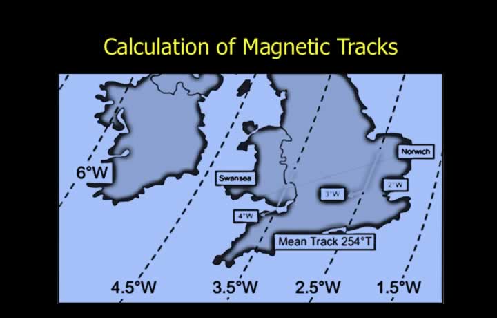
- A grid track remains constant on a grid chart.
- Subsequent conversions follow the standard heading conversion sequence:
- Grid → Convergence → True → Variation → Magnetic → Deviation → Compass
- Grivation = Convergence + Variation