Conical Projections
Conical Projections are map projections made by projecting the Earth’s surface onto a cone.
They are most accurate for regions in the middle latitudes with east-west extent.
They are commonly used in aviation charts, especially the Lambert Conformal Conic projection.
Introduction to Conical Projections
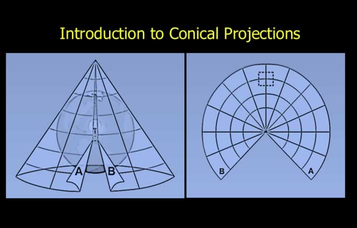
- Conical projections are produced by wrapping a sheet of paper into the shape of a cone around the Reduced Earth.
- When the cone is cut and opened, the projection appears as a sector of a circle.
- The parallel of tangency is the latitude where the cone touches the Reduced Earth.
- Scale is correct only along the parallel of tangency.
- Scale expands rapidly at both higher and lower latitudes away from the parallel of tangency.
Scale Expansion in Conical Projections
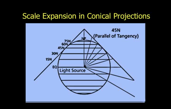
- Conical projections provide equal scale expansion in all directions around a point.
- Therefore, they are generally orthomorphic (conformal).
- Parallels of latitude are represented as concentric circular arcs.
- Meridians are represented as radial straight lines.
- Meridians and parallels intersect at right angles.
Parallel of Tangency
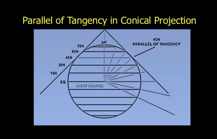
- The parallel of tangency is also known as the parallel of origin.
- It is the latitude where the cone touches the Reduced Earth.
- A conical projection forms a sector of a circle.
- The full 360° of longitude is represented by an angle of less than 360° in the sector.
Apex Angle in a Conical Projection
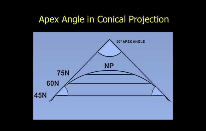
- The apex angle is the angle subtended by the sector when the cone is opened.
- The apex angle is equal to twice the parallel of tangency.
- For example, if the parallel of tangency is 45°, the apex angle is 90°.
Cone Constant
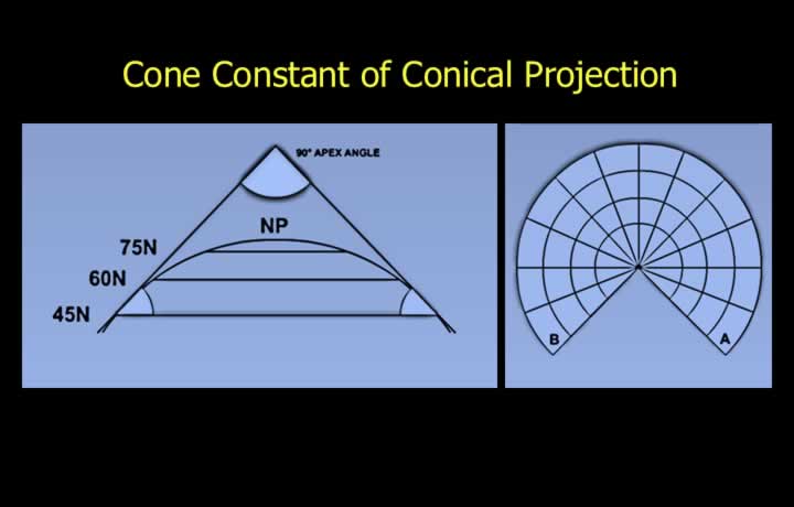
- The cone constant is equal to the sine of the parallel of origin.
- Cone Constant = sin (Latitude of Origin)
- The size of the sector depends on the cone constant.
Arc of Sector in a Conical Projection
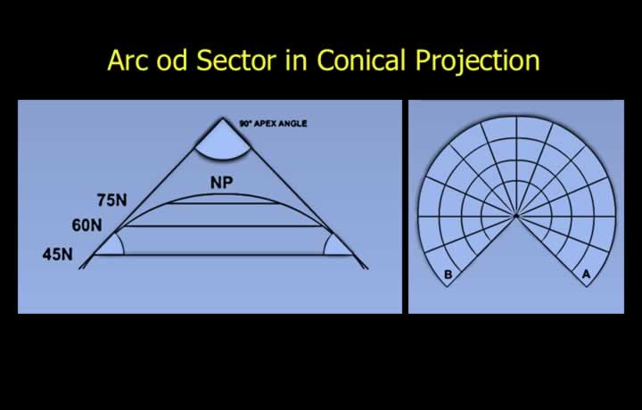
- The arc of the sector depends on the sine of the parallel of origin.
- Arc of Sector = Change in Longitude × sin (Parallel of Origin)
- Chart Convergence = Change in Longitude × Cone Constant
Scale in a Conical Projection
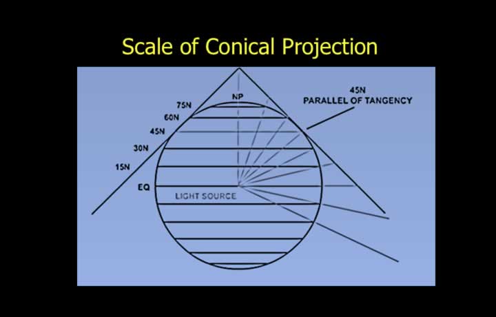
- Scale is correct where the cone touches the Reduced Earth.
- This occurs along the parallel of tangency (parallel of origin).
- Scale increases rapidly as the distance from the parallel of tangency increases.