Normal Mercator Projection
The Normal Mercator Projection is a cylindrical map projection where meridians and parallels are shown as straight lines. It preserves direction and angles, making it useful for navigation. However, it causes greater distortion of size and distance near the poles.
Introduction to the Mercator Projection
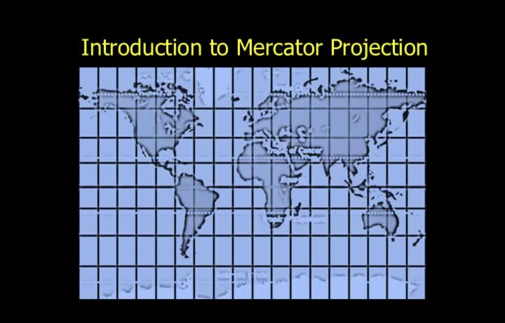
- Gerardus Mercator mathematically modified the perspective cylindrical projection.
- The Mercator modification made scale expansion equal in all directions.
- North-south and east-west scale expansions were equalized.
- Scale expansion on a Mercator chart is proportional to the secant of latitude (sec φ).
- Scale at any latitude = Scale at the Equator × sec(latitude).
- Because scale expansion is equal in all directions, the Mercator projection is orthomorphic (conformal).
- The Mercator projection is a non-perspective orthomorphic cylindrical projection.
Scale Distortion on a Mercator Projection
- Large areas and high latitudes experience significant distortion of shape and size.
- Shapes remain reasonably accurate over small areas.
- Chart convergence is correct only at the equator, where its value is zero.
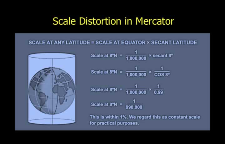
- The ICAO accepts a scale error of up to 1% as a practically constant scale.
- The scale at any latitude is obtained by multiplying the equatorial scale by the secant of latitude.
- Within 8° North and South, the scale error is less than 1%.
- Within 6° North and South, the scale error is less than 0.5%.
Scale Distortion Beyond 8° Latitude
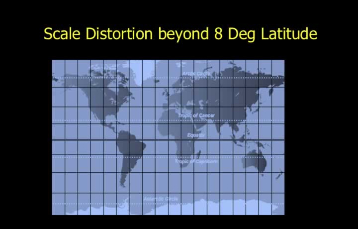
- Beyond 8° North or South, scale expansion exceeds 1%.
- The printed chart scale can no longer be used directly for accurate distance measurements.
- Distances should be measured using the local scale at the required latitude.
Rhumb Lines and Great Circles
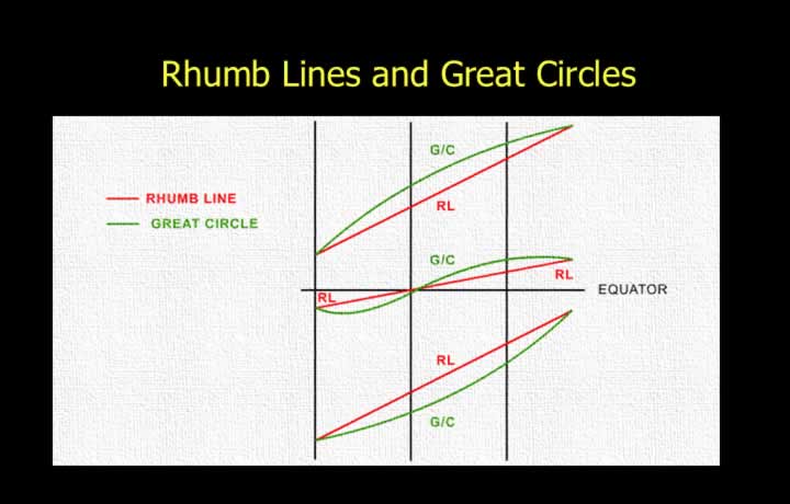
- Rhumb lines appear as straight lines because they cross all meridians at a constant angle.
- The equator and all parallels of latitude are represented as straight lines.
- Meridians are equally spaced straight lines that are perpendicular to the equator.
- Great circles (except the equator and meridians) appear as curved lines, concave toward the equator or convex toward the nearer pole.
- The equator and all meridians are both great circles and rhumb lines, so they are shown as straight lines.