Position Reference System
A position reference system in air navigation is a method used to identify an aircraft’s exact location on the Earth. It uses latitude and longitude coordinates, along with navigation systems such as GPS, to determine position accurately. This helps pilots navigate safely, follow planned routes, and reach their destination.
Properties of Great Circles
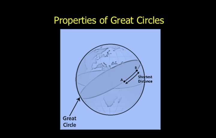
- Great circles are lines (actually circles) drawn on the surface of the Earth whose centre and radius are the same as that of the Earth.
- Properties of Great Circles:
- Centre and radius of a great circle are the same as that of the Earth.
- The plane of a great circle cuts the Earth into two equal halves.
- Only one great circle can be drawn between any two points.
- Infinite great circles are possible between two diametrically opposite points.
Importance of Great Circle
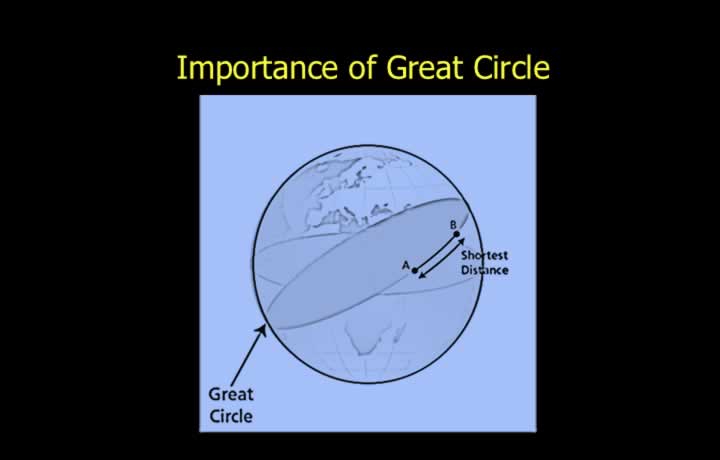
- The shorter arc of a great circle is the shortest possible distance between two points.
- Flying great circle tracks are important to airliners.
- Saves fuel and time.
Equator
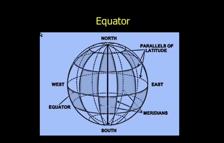
- The Equator is a great circle whose plane is 90° to the Earth’s spin axis.
- The Equator divides the Earth into two hemispheres.
- These hemispheres are called the Northern and Southern Hemispheres.
- The Equator is taken as the datum for the measurement of latitudes.
- The Equator is therefore called 0° Latitude.
Meridians and Prime Meridian
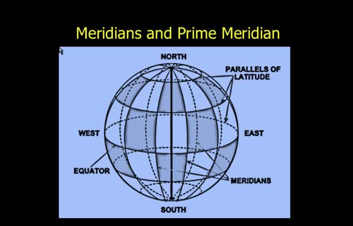
- Meridians are semi-great circles joining the poles.
- Anti-meridians are meridians 180° displaced from a meridian.
- Meridians indicate true direction since they lead to True North and South.
- All meridians and anti-meridians cut the Equator at 90°.
- The Prime (Greenwich) Meridian passes through Greenwich.
- The Prime Meridian is taken as the datum for defining longitudes.
- The Prime Meridian is also called 0° Longitude.
Properties of Small Circles
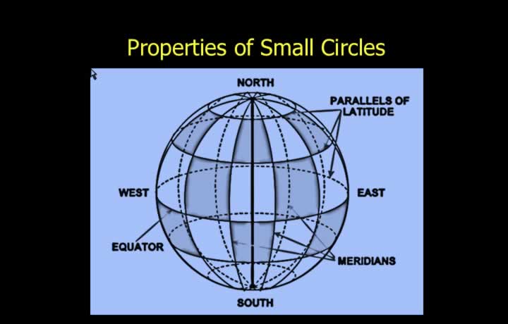
- Small circles are circles drawn on the Earth’s surface whose centre and radius are not the same as that of the Earth.
- Properties of Small Circles:
- Centre and radius are not the same as that of the Earth.
- The plane of a small circle cuts the Earth into unequal halves.
Parallels of Latitude
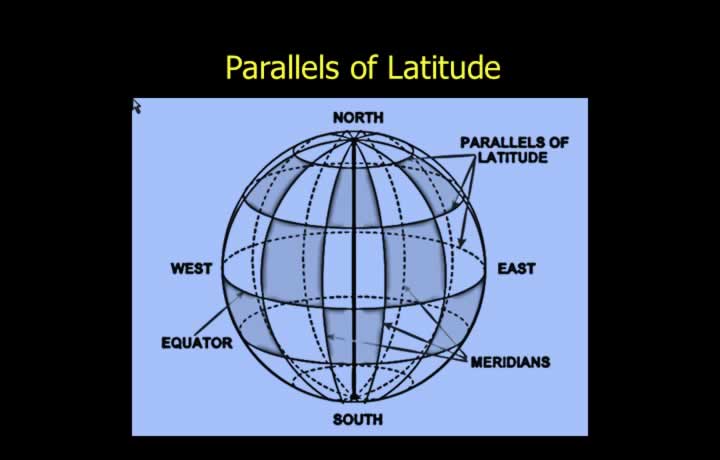
- Parallels of latitude are small circles parallel to the Equator.
- Parallels are perpendicular to the Earth’s spin axis.
- All parallels indicate East-West direction.
Special Latitudes
- Equator – 0° Latitude.
- Arctic Circle – 66½° North.
- Antarctic Circle – 66½° South.
- Tropic of Cancer – 23½° North.
- Tropic of Capricorn – 23½° South.
Position Reference System
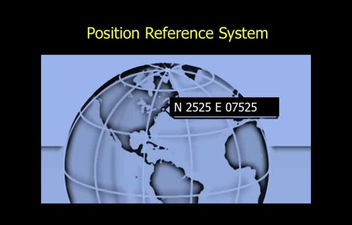
- A Position Reference System denotes a place on Earth without ambiguity.
- It is similar to the Cartesian coordinate system using X and Y axes.
- Latitudes and longitudes are used to identify any point uniquely.
- Latitudes are expressed North or South of the Equator.
- Longitudes are expressed East or West of the Prime Meridian.
Graticule
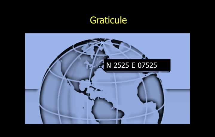
- A graticule is the network formed by parallels of latitude and meridians.
- Position is normally expressed in degrees, minutes and seconds of arc.
- Sometimes, seconds are replaced by decimal minutes.
- By convention, latitude is written first, followed by longitude.
Measurement of Latitude
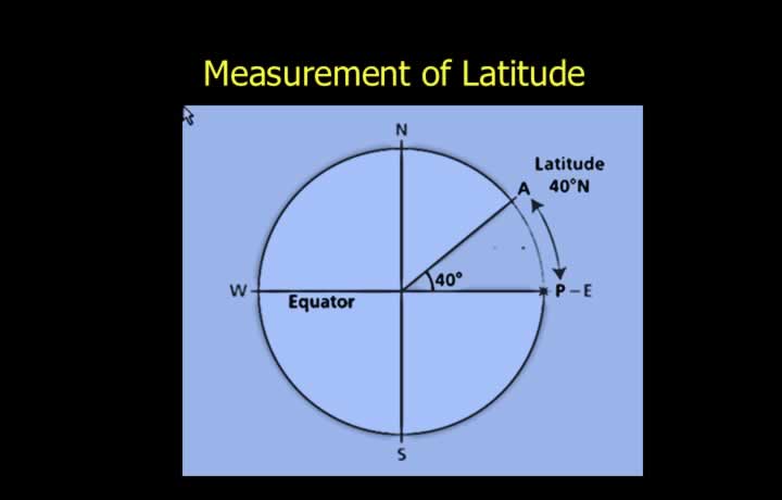
- Latitude is the smaller arc of a meridian between the Equator and the point.
- Measured as an angular distance from the Equator.
- Expressed in degrees, minutes and seconds.
- Denoted as North or South of the Equator.
Geocentric Latitude
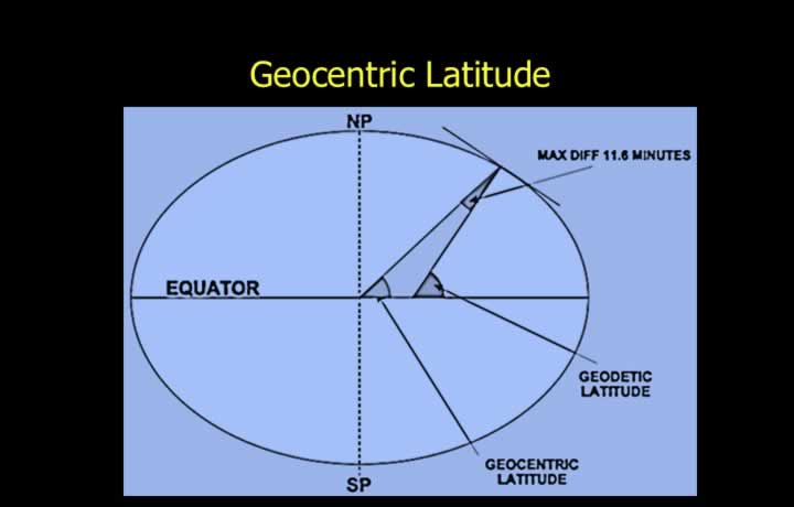
- Measured between the line joining the point to the Earth’s centre and the plane of the Equator.
- Not used in navigation because the Earth is not a perfect sphere.
Geodetic (Geographic) Latitude
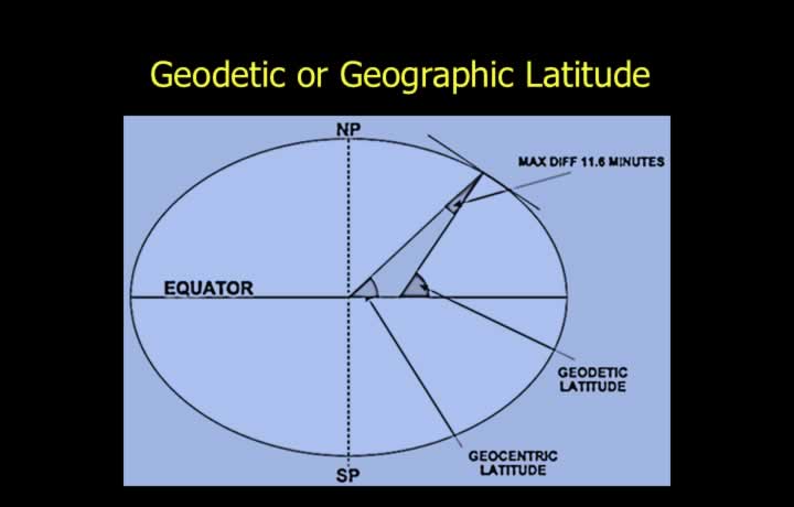
- Measured between the normal to the meridian at a point and the plane of the Equator.
- The normal is perpendicular to the tangent of the meridian.
- The normal does not necessarily pass through the Earth’s centre.
- The maximum difference between geocentric and geodetic latitude is 11.6 minutes.
- This maximum difference occurs at 45° North and South.
Measurement of Longitude
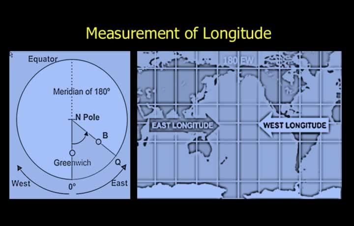
- Longitude is the shorter arc of the Equator between the Prime Meridian and the meridian passing through the point.
- Measured from 0° to 180°.
- Expressed as East or West of the Prime Meridian.
Orientation of Longitudes
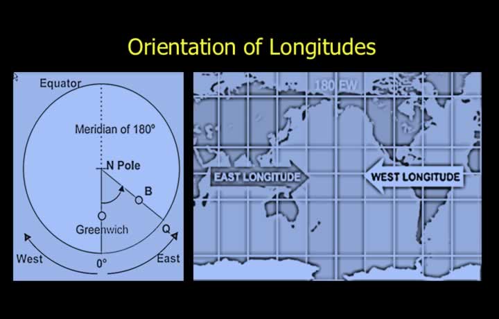
- While looking at the Prime Meridian:
- Easterly longitudes are on the right.
- Westerly longitudes are on the left.
- While looking at the Anti-Meridian:
- Easterly longitudes are on the left.
- Westerly longitudes are on the right.
Change in Latitude
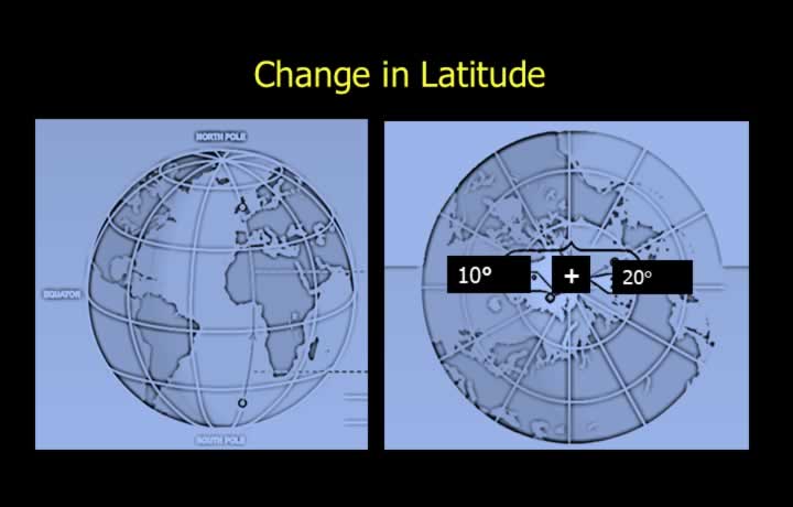
- Change in latitude is the difference in latitude between two points.
- Measured along the meridian.
- Expressed in degrees, minutes and seconds.
Distance Using Change in Latitude
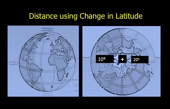
- Change of Latitude (Ch Lat) is expressed as North or South of the other point.
- Distance between two points on a great circle can be calculated using Ch Lat.
- Variation is considered along the shorter great-circle path.
Change in Longitude
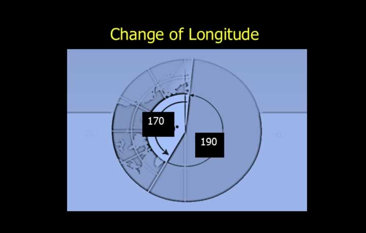
- Change in longitude is the difference in longitude between two points.
- It is the smaller angular difference measured along the Equator.
- Expressed in degrees, minutes and seconds.
Distance Using Change in Longitude
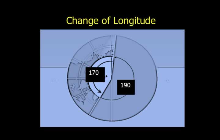
- Change of Longitude (Ch Long) is expressed as East or West of the other point.
- Distance between two points on the Equator can be calculated using Ch Long.
- Variation is considered along the shorter great-circle path.
- If the change in longitude exceeds 180°, recalculate using the opposite direction.
Accuracy of Graticule
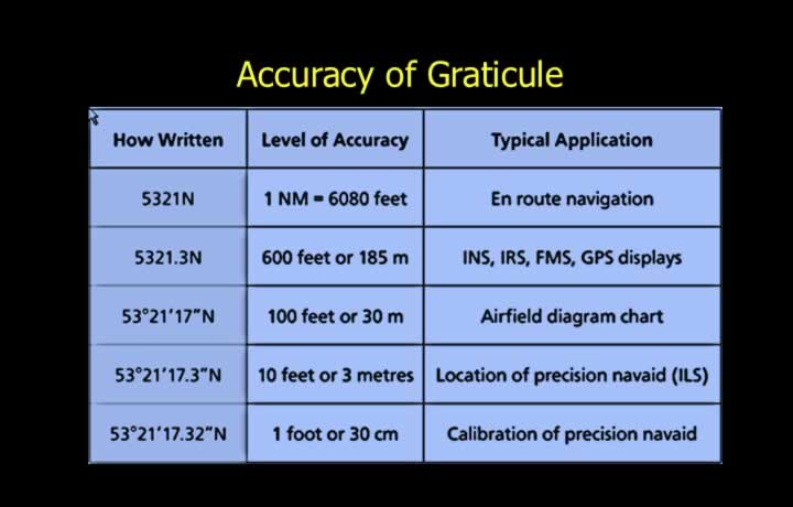
- One degree of arc is the fundamental unit of angular measurement.
- One degree equals 1/360 of the circumference of a circle.
- One minute of arc (‘) is 1/60 of a degree.
- One second of arc (“) is 1/60 of a minute.
Requirement of Accuracy of Graticule
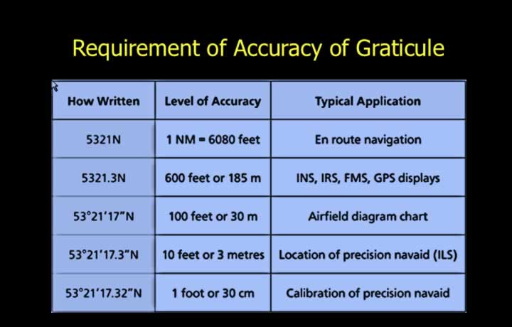
- Latitudes and longitudes are angular measurements on the Earth’s surface.
- En-route charts use degrees, minutes and seconds.
- Modern avionics, such as Flight Management Systems (FMS), use decimal minutes.
- Precision aids like the Instrument Landing System (ILS) use decimal seconds.