Cylindrical Projections
Cylindrical projections represent the Earth’s surface by projecting it onto a cylinder. They are useful for showing areas near the equator with accurate directions. The Mercator projection is a common type of cylindrical projection used in navigation. It shows meridians and parallels as straight lines crossing at right angles. Distortion increases as the distance from the equator increases.
Introduction to Projections

- Map projections are used to represent the spherical Earth on a flat surface.
- Traditionally, map preparation was carried out in three stages.
- A scaled three-dimensional model of the Earth, known as the Reduced Earth, was prepared.
- Light was projected from inside the Reduced Earth onto a sheet of paper wrapped around it.
- The wrapped paper was then cut open to display the graticule (network of latitudes and longitudes).
Perspective and Non-Perspective Projections
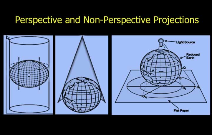
- Perspective projections are obtained directly using a light source.
- These projections are used without mathematical modification.
- Non-perspective projections are mathematically modified versions of perspective projections.
- Most practical map projections are non-perspective projections.
Cylindrical Projections
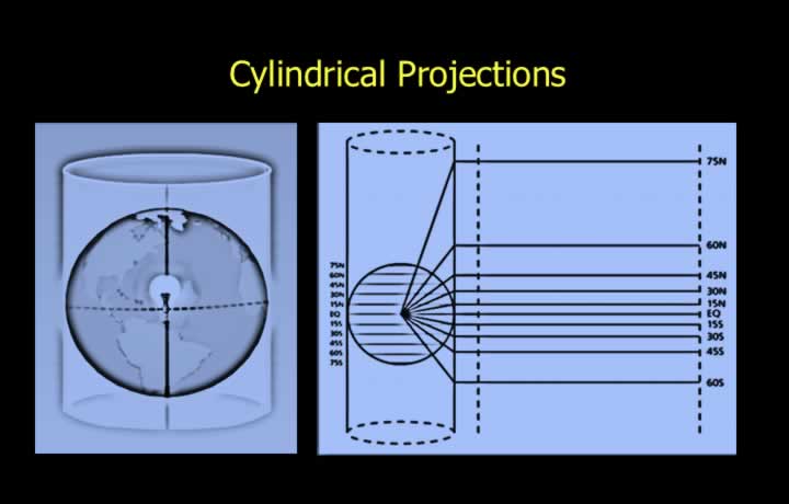
- A cylindrical projection is produced by wrapping a cylindrical sheet around the Reduced Earth.
- In a normal cylindrical projection, the cylinder touches the Earth at the equator.
- The equator is known as the parallel of tangency or parallel of origin.
- Scale is correct only at the equator because the projected light travels the correct distance at the point of tangency.
Orthomorphism of Cylindrical Projections
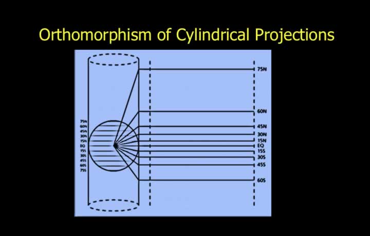
- Scale expands as the distance from the equator increases because the projected light travels a greater distance.
- Scale expansion causes smaller areas to appear larger.
- The north-south scale expansion is different from the east-west scale expansion.
- Therefore, a perspective cylindrical projection is not orthomorphic (not conformal).
- However, meridians and parallels are represented by straight lines intersecting at right angles.
Scale of Cylindrical Projections
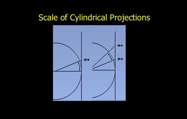
- In all perspective projections, scale is correct only at the parallel of tangency.
- The parallel of tangency is also called the parallel of origin.
- The projection surface touches the Reduced Earth only along this parallel.
- For a normal cylindrical projection, the equator is the parallel of tangency.
Scale Variation in Cylindrical Projections
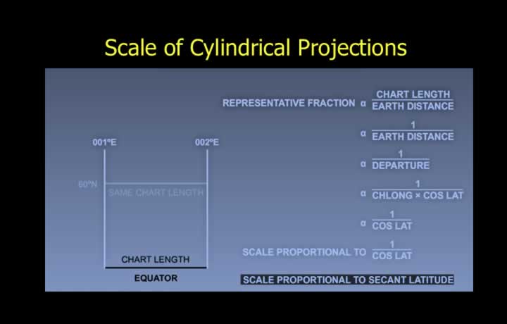
- Scale is correct at the parallel of tangency and increases at all other latitudes.
- The north-south scale expands in proportion to the tangent of latitude (tan φ).
- The east-west scale expands in proportion to the secant of latitude (sec φ).
Conditions for Orthomorphism
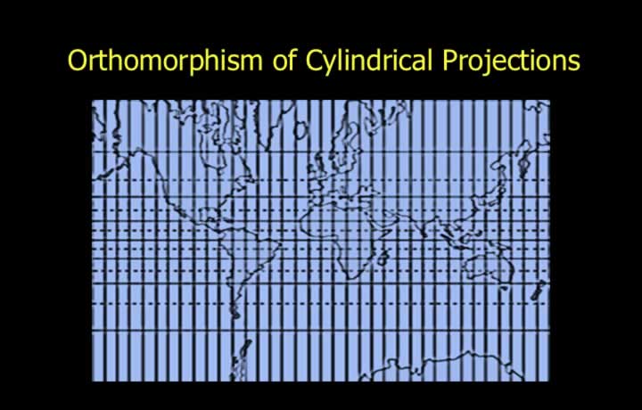
- Orthomorphism means that angles and bearings measured on the chart are identical to those on the Earth’s surface.
- A projection is orthomorphic only if the following conditions are satisfied:
- Meridians and parallels intersect at right angles.
- Scale is the same, or expands equally, in every direction around a point.
Orthomorphism of Perspective Cylindrical Projections
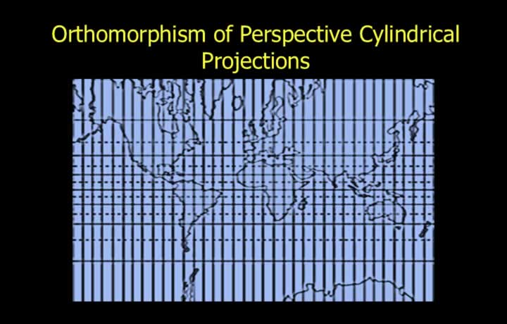
- Perspective cylindrical projections are non-orthomorphic.
- The north-south scale varies as the tangent of latitude (tan φ).
- The east-west scale varies as the secant of latitude (sec φ).
- Since scale expansion is unequal in different directions, angles and bearings are not preserved accurately.