
Smart Display using Electronic Flight Information System (EFIS)
Electronic Flight Information System (EFIS) is a digital display system that presents essential flight and navigation information to pilots. It includes displays such as the Primary Flight Display (PFD) and Navigation Display (ND), replacing many traditional analogue instruments. EFIS improves situational awareness, reduces pilot workload, and enhances flight safety through clear, integrated information.
Electronic Flight Information System (EFIS)
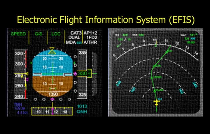
- The Electronic Flight Information System (EFIS) interfaces with the Flight Management System (FMS) to provide integrated flight information and navigation displays.
- An EFIS typically consists of the following subsystems:
- Electronic Horizontal Situation Indicator (EHSI).
- Electronic Attitude Direction Indicator (EADI).
- EFIS Control Panel.
- Symbol Generator.
- Remote Light Sensor.
Colour Coding in EFIS
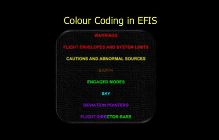
The following colour conventions are commonly used in Airbus EFIS displays:
- Red – Warnings, flight envelope limits and system limitations.
- Yellow – Cautions and abnormal operating conditions.
- Green – Selected modes and normal operating indications.
- Blue – Sky background.
- Magenta – Navigation deviation pointers and active navigation guidance.
- Green or Magenta – Flight Director command bars.
EFIS Symbols
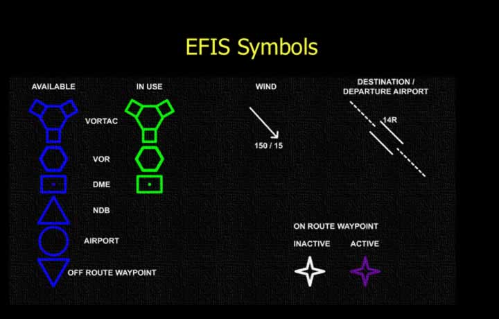
Common navigation symbols displayed on the EFIS include:
- VORTAC.
- VOR.
- DME.
- NDB.
- Airports.
- Off-route waypoints.
- Active waypoint.
- Other waypoints.
- Wind direction and velocity.
- Selected runway.
- Extended runway centreline.
Modes of FMS Displays
EHSI Display Modes
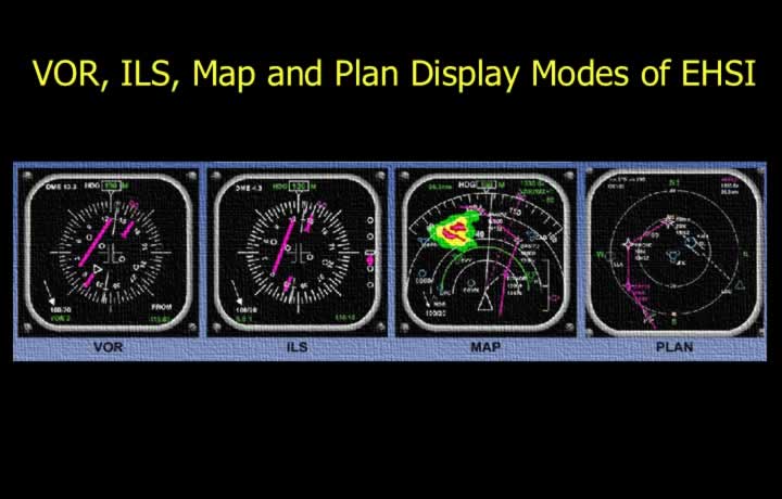
VOR Mode
- Displays VOR navigation information using a full 360° compass rose.
ILS Mode
- Displays Instrument Landing System (ILS) information on a full compass rose.
MAP Mode
- Displays a moving map with the aircraft position continuously updated.
- Can overlay information from:
- TCAS (Traffic Collision Avoidance System).
- EGPWS (Enhanced Ground Proximity Warning System).
- Weather Radar.
PLAN Mode
- Displays a north-up static map.
- Primarily used for reviewing and modifying the flight plan while airborne.
Expanded VOR, Expanded ILS and Centre MAP Modes
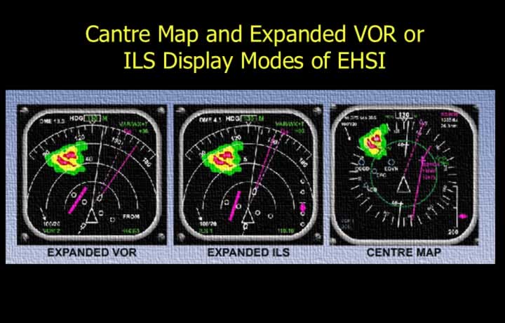
Expanded VOR Mode
- Displays VOR information over a 90° compass sector.
- Allows simultaneous display of weather radar information.
Expanded ILS Mode
- Displays ILS information over a 90° compass sector.
- Allows weather radar information to be displayed simultaneously.
Centre MAP Mode
- Displays a moving map with the aircraft symbol positioned at the centre of the display.
Failure Warnings in EHSI
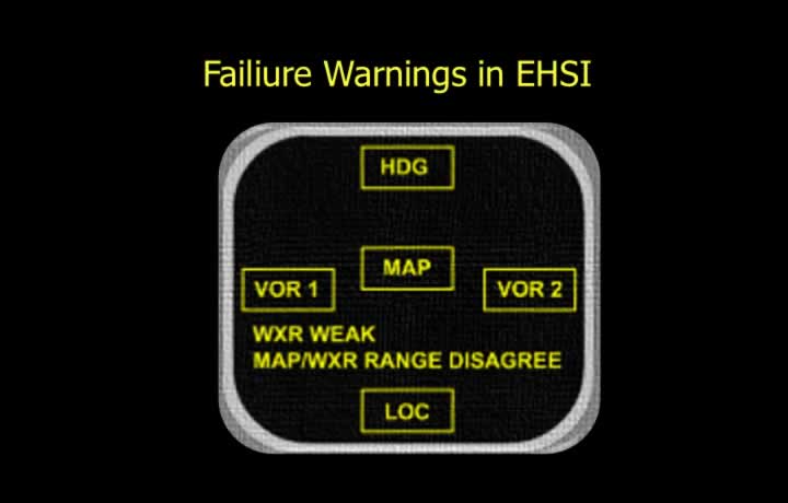
- Failure annunciations warn the crew of navigation data source failures.
- Monitored data sources include:
- Heading reference.
- VOR.
- ILS Localiser.
- ILS Glide Path.
- Indicates weak or unreliable weather radar signals.
- Alerts the crew when navigation inputs from different systems do not agree.