
Area Navigation System (RNAV)
Area Navigation (RNAV) is a navigation method that allows aircraft to fly on any desired flight path within the coverage of navigation aids or using onboard navigation systems. It uses systems such as GNSS, DME/DME, and INS/IRS to determine the aircraft’s position accurately. RNAV improves route efficiency, reduces flight time and fuel consumption, and enhances airspace capacity.
Area Navigation System (RNAV)
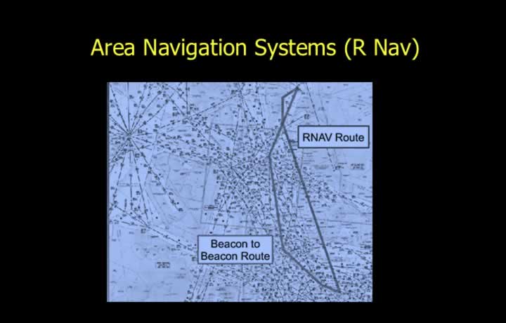
- Area Navigation (RNAV) is a navigation system that allows an aircraft to fly on any desired flight path.
- The flight path may be referenced to ground-based navigation aids such as VOR/DME.
- It may also be referenced to self-contained navigation systems such as INS or IRS.
- RNAV can combine information from both ground-based and self-contained navigation aids.
- RNAV enables aircraft to fly directly between waypoints without passing overhead ground navigation facilities.
Required Navigation Performance (RNP)
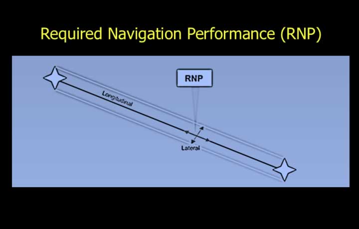
- Required Navigation Performance (RNP) defines the navigation accuracy required when operating on RNAV routes.
- Accuracy is specified at a 95% probability level.
- The requirement applies in both the lateral and longitudinal directions.
- Example: RNP 5 means:
- 95% of aircraft operating on the route remain within 5 NM of their intended position.
- An aircraft will remain within 5 NM of its calculated position for 95% of the flight time.
Mandatory Accuracy for Required Navigation Performance
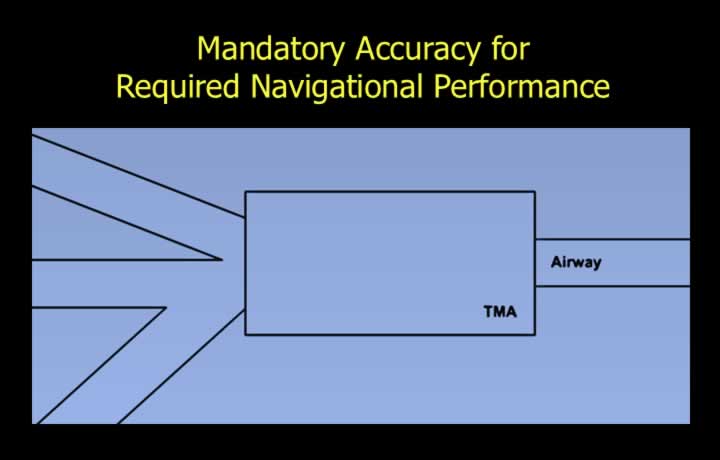
- RNP requirements may be specified for:
- A single route.
- A group of routes.
- A defined area.
- A specified volume of airspace.
- RNAV systems determine aircraft position using information from:
- VOR
- DME
- GPS
- ILS
- MLS
- INS
- IRS
- Air Data Computer (ADC)
- Time information
- The system processes these inputs to calculate:
- Track Made Good (TMG).
- Estimated Time of Arrival (ETA).
Air Traffic Management using Area Navigation Systems
Advantages of RNAV Routes
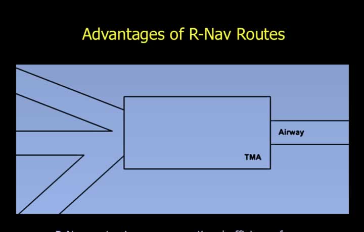
Operational Advantages
- Aircraft can fly direct routes over the shortest distance.
- Reduced flight time.
- Lower fuel consumption.
- Reduced operating costs.
Air Traffic Control Advantages
- Increased route capacity.
- Additional route options.
- Reduced horizontal and vertical separation requirements where approved.
- Greater flexibility in traffic management.
- Provision of:
- ATC-designed RNAV routes.
- Bypass routes.
- Contingency routes.
- Optimum holding patterns and locations.
- Reduced dependence on ground-based navigation facilities.
2D, 3D and 4D Area Navigation Systems
Types of RNAV Systems
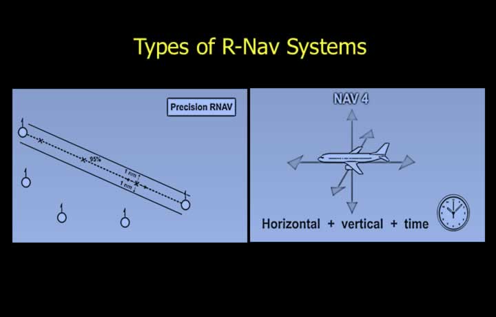
- Basic RNAV provides navigation accuracy of 5 NM (95% probability).
- Precision RNAV (P-RNAV) provides navigation accuracy of 1 NM (95% probability).
Levels of RNAV Guidance
- 2D RNAV – Horizontal guidance only.
- 3D RNAV – Horizontal and vertical guidance.
- 4D RNAV – Horizontal, vertical and time-based navigation.
RNAV Control Unit
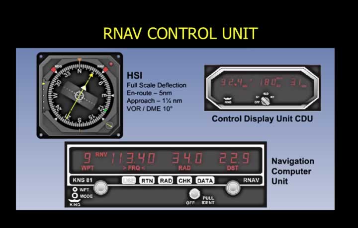
Waypoint Inputs
- Waypoint number.
- Navigation beacon frequency.
- Bearing and distance from the reference beacon.
RNAV Display
- RNAV guidance is displayed on the Horizontal Situation Indicator (HSI).
- Full-scale HSI deflection represents:
- 5 NM deviation during the en-route phase.
- 1.5 NM deviation during the approach phase.
- 10° deviation while tracking inbound or outbound using VOR/DME.
RNAV Routes Based on Phantom Stations
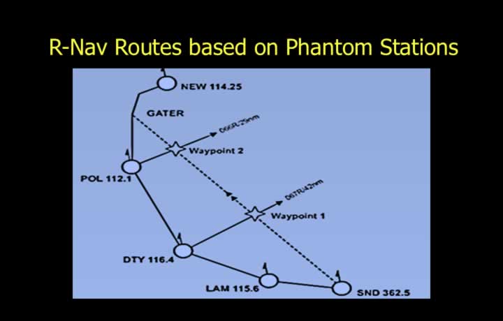
- RNAV routes are constructed using Phantom Stations.
- Phantom Stations are computer-generated RNAV waypoints.
- These waypoints are defined by their bearing and distance from existing VOR/DME stations.
Limitations of 2D RNAV System
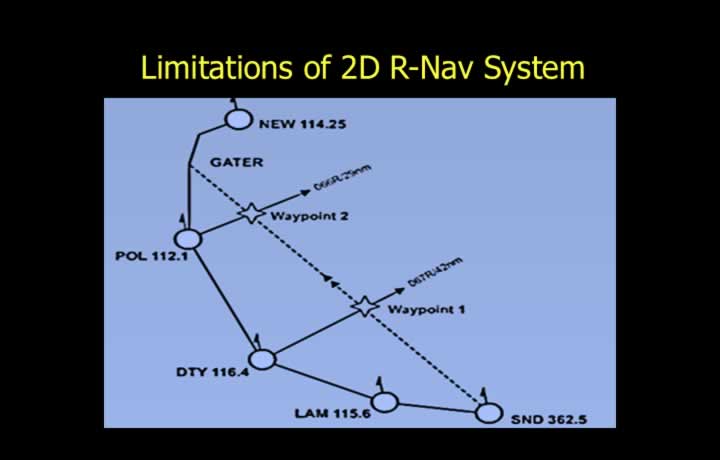
- 2D RNAV depends upon VOR/DME signals being within line of sight.
- Mountainous terrain may block navigation signals.
- The aircraft must remain within the Designated Operational Coverage (DOC) of the VOR/DME.
- Outside the DOC, navigation inputs may become inaccurate.
- DME measures slant range, which can introduce errors when flying close to the station.
4D RNAV Operation
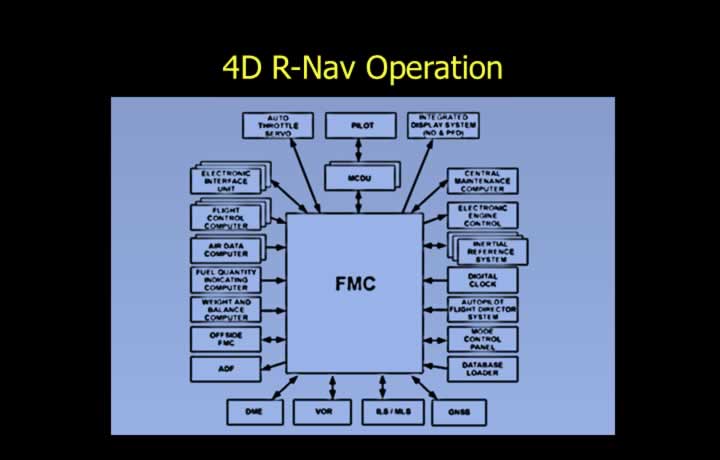
- 4D RNAV receives inputs from:
- INS
- IRS
- GPS
- VOR/DME
- The Flight Management Computer (FMC) compares all available navigation sources to determine the most accurate aircraft position.
- The FMC automatically selects the best navigation solution.
Navigation Priority
- DME/DME Fix – Preferred due to highest accuracy.
- VOR/DME Fix – Second preference because VOR accuracy is limited to approximately ±5°.
- VOR/VOR Fix – Third preference because accuracy decreases significantly with distance (approximately 35 NM).
Advanced Dead Reckoning by the Flight Management Computer (FMC)
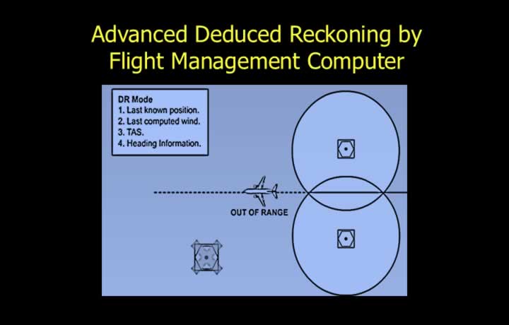
- 4D RNAV performs an advanced form of Dead Reckoning (DR).
- The FMC receives:
- True Airspeed (TAS) from the Air Data Computer (ADC).
- Heading from the Remote Indicating Compass (RIC) or heading reference system.
- The FMC calculates the actual wind velocity using these inputs.
- If the aircraft is outside VOR/DME coverage, the FMC uses IRS or INS for navigation.
- Dead Reckoning calculations are based on:
- Last known position.
- Aircraft heading.
- True Airspeed (TAS).
- The FMC computes steering commands to fly the most efficient Great Circle Route.