Satellite assisted Navigation using Global Navigation Satellite System (GNSS)
Global Navigation Satellite System (GNSS) is a satellite-based navigation system that provides accurate aircraft position, velocity, and time information worldwide. It uses signals from satellite constellations such as GPS, GLONASS, Galileo, and BeiDou to determine the aircraft’s location. GNSS supports en-route navigation, area navigation (RNAV), precision approaches, and improves flight safety and efficiency.
Global Navigation Satellite System (GNSS)
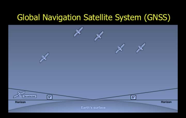
- GPS is a Global Navigation Satellite System (GNSS) with two levels of accuracy.
- Standard Positioning Service (SPS) provides an accuracy of approximately 30 m and is available to all users.
- Precise Positioning Service (PPS) provides an accuracy of approximately 1 m and is available only to the U.S. military.
- Equivalent Global Navigation Satellite Systems include:
- GPS (USA)
- GLONASS (Russia)
- Galileo (Europe)
- BeiDou (China)
- NavIC (India)
Kepler’s Laws of Planetary Motion
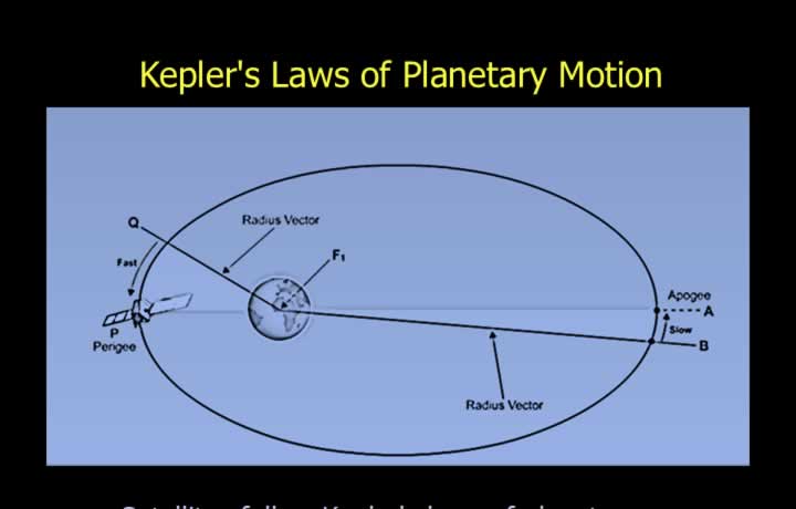
- GPS satellites follow Kepler’s Laws of Planetary Motion.
- An elliptical orbit is one in which the sum of the radius vectors is constant.
- The radius vector is the line joining the Earth and the satellite.
- First Law: A satellite moves in an elliptical orbit with the Earth at one focus.
- Second Law: The radius vector sweeps out equal areas in equal intervals of time.
- A satellite travels faster when it is closer to the Earth.
- Third Law: The square of the orbital period is proportional to the cube of its average distance from the Earth.
Position Reference System
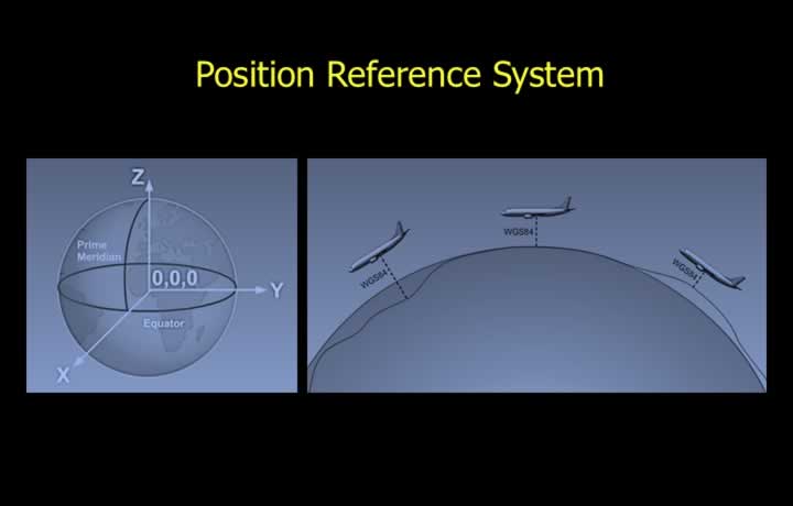
- GPS positions are referenced to the center of the Earth in three dimensions.
- Cartesian coordinates with the Earth’s center as the origin are used.
- GPS is based on the World Geodetic System 1984 (WGS-84).
- WGS-84 approximates the Earth as a reference ellipsoid.
- The Earth is not a perfect sphere, and mean sea level is not constant.
- Aircraft height near the Earth’s surface should therefore be interpreted with caution.
Components of Global Navigation System
GPS Segments
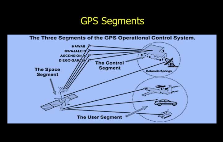
- The GPS system consists of three segments:
- Space Segment – GPS satellites with atomic clocks.
- Control Segment – Ground monitoring and control stations.
- User Segment – GPS receivers.
GPS Space Segment
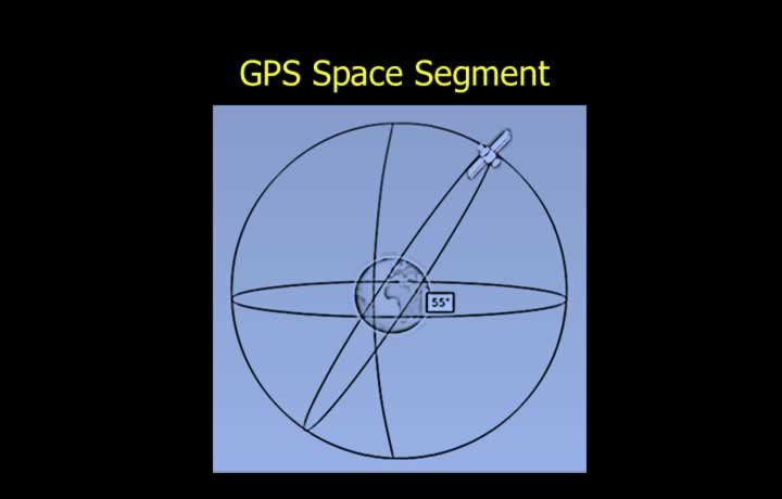
- Satellites are known as Space Vehicles (SVs).
- The constellation consists of 24 Space Vehicles (21 operational and 3 spare).
- Satellites are distributed in 6 orbital planes.
- Average orbital altitude is approximately 20,180 km.
- Orbital period is approximately 12 hours.
Orbital Planes
- Orbital planes are equally spaced around the equator.
- Each orbital plane is inclined at approximately 55° to the equator.
Space Vehicles Above the Horizon
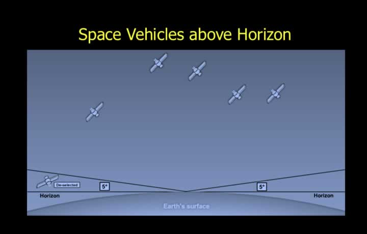
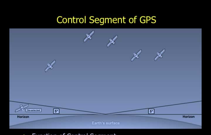
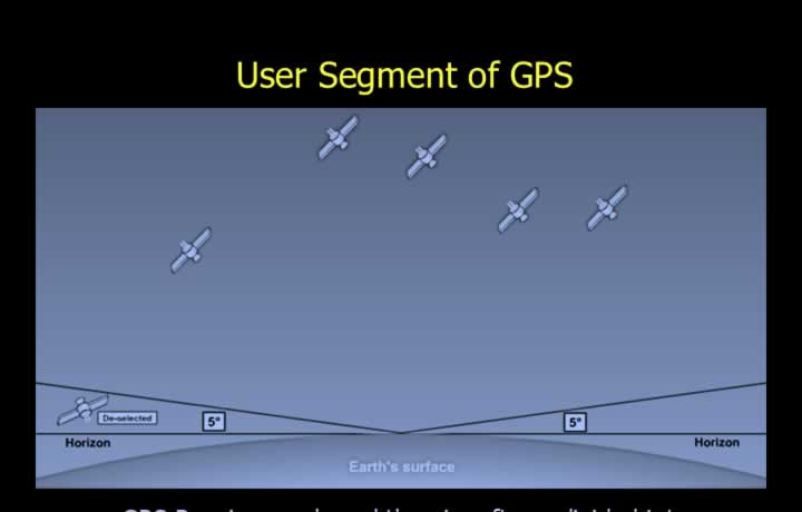
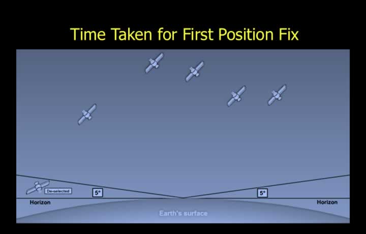
- The GPS constellation is designed so that any observer normally has 5–8 satellites in view.
- A satellite is considered “in view” only if it is at least 5° above the horizon.
- Satellites below 5° elevation are masked and not used for navigation.
Standard Positioning Service (SPS) and Precise Positioning Service (PPS)
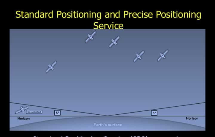
- SPS uses only the Coarse Acquisition (C/A) Code.
- Available to all civilian users.
- PPS uses both the C/A Code and the Precision (P) Code.
- Available only to the U.S. military.
- The navigation message includes:
- Satellite position.
- Clock time.
- Clock correction.
- Ionospheric conditions.
- Almanac.
- Satellite health.
- Time.
- Command and control information.
Working Principle of GPS
GPS Pseudo Random Noise (PRN) Code
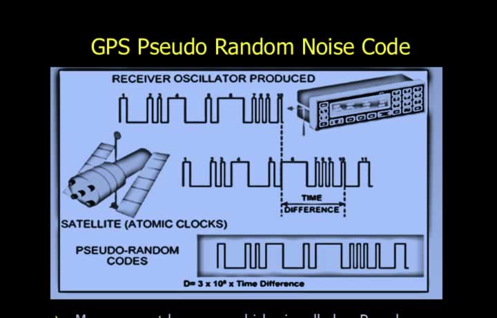
- The signal transmitted by each satellite is called the Pseudo Random Noise (PRN) Code.
- Although it appears random, it follows a unique repeating sequence.
- Each satellite transmits its own unique PRN code.
- The code repeats every 1 millisecond.
Coarse Acquisition (C/A) Code
- Broadcast on L1 frequency: 1575.42 MHz.
- Chip rate of 1.023 MHz.
- Repeats every 1 millisecond.
Precision (P) Code
- Broadcast on L2 frequency: 1227.60 MHz.
- Chip rate of 10.23 MHz.
- Navigation data modulation rate of 50 Hz.
- Complete sequence repeats approximately every 7 days.
- Encrypted P-Code is known as the Y-Code and is protected by anti-spoofing measures.
GPS Space Vehicle Navigation Message
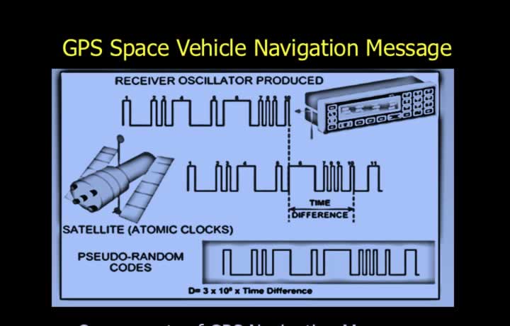
- The navigation message consists of one 30-second frame.
- Each frame contains 5 subframes of 6 seconds each.
- The navigation message contains:
- Telemetry Word (TLM).
- Handover Word (HOW).
- GPS Time of Week.
- Satellite clock correction data.
- Ephemeris data.
- Ionospheric model.
- UTC correction.
- Satellite constellation almanac.
- A complete almanac requires approximately 25 frames to download.
Function of GPS Receiver
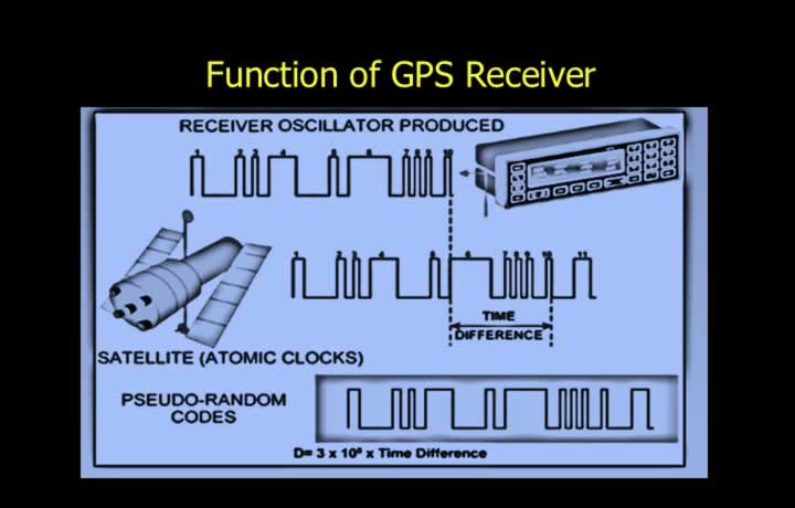
- The receiver acquires the PRN code from the satellite.
- It generates an identical internal PRN code.
- The time delay between transmitted and received codes is measured.
- This delay is converted into the distance between the satellite and the aircraft.
- A minimum of four satellites is required for a complete position fix.
GPS Position Fix
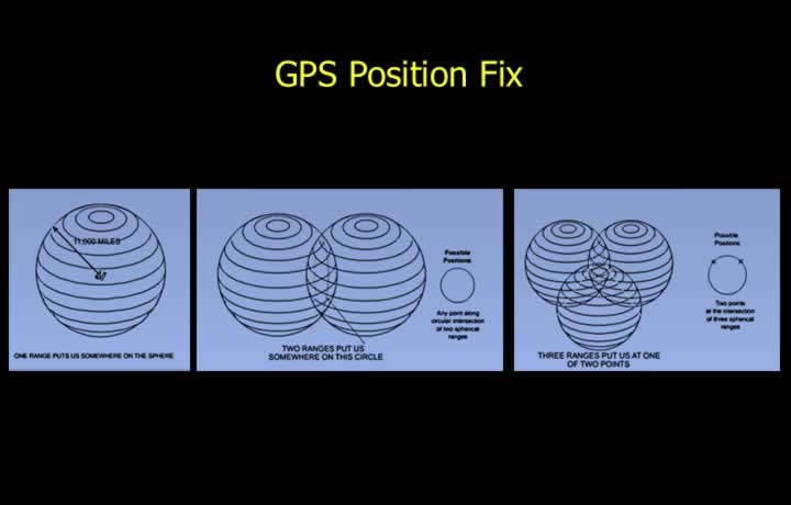
- A three-dimensional position fix is obtained using pseudo-ranges from four satellites.
- One satellite provides a spherical position line.
- Two satellites produce a circular position line.
- Three satellites reduce the solution to two possible positions.
- One solution lies in space, while the other is on or near the Earth’s surface.
- Four satellites provide one unique position and correct the receiver clock error.
Management of GPS System<>
Control Segment of GPS
- The Control Segment calculates satellite position errors caused by:
- Gravitational effects of the Sun, Moon, and planets.
- Solar radiation pressure.
- The Master Control Station supervises monitoring and operational stations.
- A Backup Control Station provides redundancy.
Monitoring Stations
- Monitor satellite position and clock accuracy approximately every 12 hours.
- Transmit updated position and clock corrections to satellites.
- Correct orbital and clock errors.
Operational Control Stations
- Monitor the health of GPS satellites.
- The National Geospatial-Intelligence Agency (NGA) provides precise orbital information.
- Future monitoring stations support continued system expansion.
User Segment (Receivers) of GPS
Sequential Receiver
- Scans satellites sequentially using one or two channels.
- Determines pseudo-ranges one satellite at a time.
Multiplex Receiver
- Rapidly switches between satellites.
- Provides a faster Time to First Fix (TTFF).
Multi-Channel Receiver (All-in-View)
- Tracks all visible satellites simultaneously.
- Selects the most suitable satellites for navigation.
GPS Display
- May be displayed on a moving map.
- Shows aircraft latitude and longitude.
- Displays UTC date and time.
- Shows aircraft track and ground speed.
GPS Range Position Line
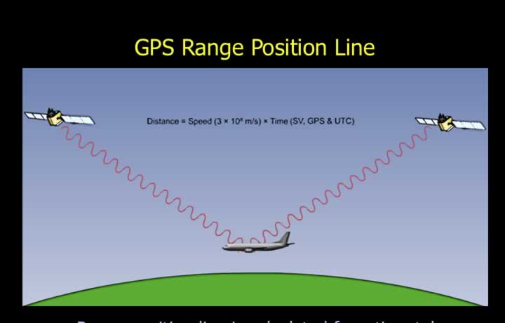
- The range position line is determined from the time taken for the radio signal to travel from the satellite to the receiver.
- Each satellite carries Caesium and Rubidium atomic clocks.
- The Master Control Station continuously updates clock corrections.
- Accurate time information is transmitted in the navigation message.
- The receiver clock is less accurate and is corrected during signal processing.
- GPS time is measured from the GPS epoch of 5 January 1980.
- The corrected time delay is used to calculate the pseudo-range.
Time Taken for First Position Fix (TTFF)
- If the receiver already has a current almanac and approximate position, it can begin navigation immediately.
- If no almanac is available, the Time to First Fix is approximately 15 minutes:
- 12.5 minutes to download the almanac.
- 2.5 minutes to search for suitable satellites.
- 30 seconds to calculate the first position fix.
Errors of GPS

- GPS is affected by several sources of error, including:
- Clock Bias
- Space Vehicle (SV) Geometry
- Space Vehicle Ephemeris Error
- Space Vehicle Clock Bias
- Orbital Perturbations
- Geometric Dilution of Precision (GDOP)
- Ionospheric Propagation Error
- Ionospheric Delay
- Selective Availability
- Receiver Noise
- Multipath Error
- Receiver Manufacturing Error
- Tropospheric Error
ICAO Permissible Limits of GPS Error

- GPS accuracy is expressed at a 95% probability level.
- This means that the stated accuracy is achieved in 19 out of 20 measurements.
- ICAO navigation accuracy requirements are:
- Horizontal error: Less than 13 m.
- Vertical error: Less than 22 m.
- Time error: Less than 40 nanoseconds (UTC).
Clock Bias Error

- Clock bias occurs because of differences between the satellite clock and the receiver clock.
- The receiver intentionally introduces a small clock error to minimize this effect.
- This technique produces a cocked-hat position error.
- The resulting clock bias error is restricted to a single direction.
Space Vehicle Geometry, Ephemeris and Orbital Perturbations

- SV Geometry Error occurs when satellites are not positioned optimally in the sky.
- Ephemeris Error results from inaccuracies in the satellite’s predicted orbit caused by gravitational forces and solar radiation.
- Orbital Perturbations occur due to the gravitational influence of nearby celestial bodies and other satellites.
- SV Clock Bias results from errors in the satellite’s atomic clock.
- Satellite clock errors can introduce position errors of up to approximately 1.5 m.
Geometric Dilution of Precision (GDOP)

- GDOP occurs due to poor satellite geometry.
- Poor geometry results when satellites are clustered close together.
- The ideal geometry consists of:
- One satellite nearly overhead.
- Three satellites spaced approximately 120° apart around the horizon.
Ionospheric Propagation Error and Delay

- Ionospheric propagation error occurs because actual ionospheric conditions differ from the average model stored in the receiver.
- The error may reach approximately 5 m for a single satellite.
- Ionospheric delay is inversely proportional to the square of the satellite transmission frequency.
- The delay can be estimated by comparing signals received on different frequencies.
Selective Availability

- GPS was originally developed as a military navigation system.
- Selective Availability (SA) was an intentional degradation of civilian GPS accuracy introduced by the U.S. Air Force.
- Accuracy was reduced by intentionally varying satellite clock timing.
- This technique was known as Dithering.
- The resulting error could reach approximately 100 m.
Receiver Noise, Multipath, Manufacturing and Tropospheric Errors

- Receiver Noise is caused by internal electronic noise within the GPS receiver.
- Typical receiver noise error is approximately 0.3 m.
- Multipath Error occurs when GPS signals are reflected from the ground, buildings or other objects before reaching the receiver.
- Receiver Manufacturing Errors result from hardware imperfections.
- Tropospheric Error is caused by variations in atmospheric pressure, density, temperature and humidity.